
Standard visit
A sandbar cape on the northeast tip of Ko Yao Yai that stretches out into Phang Nga Bay when the tide drops, facing Ko Yao Noi across the channel.
A free, quiet cape on Ko Yao Yai whose sand spit pushes out toward Ko Yao Noi whenever the tide is low.
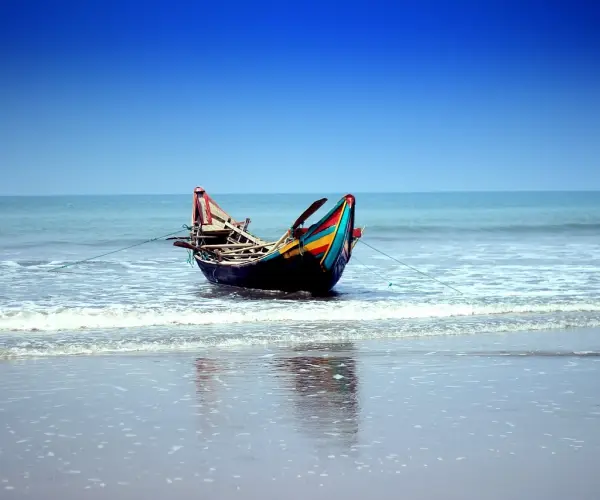
Laem Hat, also written Laem Had or Laem Haad, is the cape at the northeast tip of Ko Yao Yai. Its draw is a tongue of sand that reaches into the sea toward Ko Yao Noi, and the Thai government tourism portal names that point between the two islands as the beach's main highlight.
The bar is only fully exposed at low water; at high tide much of it disappears. A Trip.com traveler guide notes the two shores appearing to meet around early afternoon on some days, but timings move with the lunar cycle, so look up a local tide table the evening before rather than relying on a fixed hour.
This is an open beach with no ticket booth and little shade. The mood is quiet and mostly about photographs and a shallow paddle.
Laem Hat pairs easily with Ko Khai and Ko Khai Nok off the island's coast, and the view across the channel takes in Ko Yao Noi. James Bond Island is a separate boat day from here (Thai Holiday Guide, updated September 2026).
Checked against trusted sources:
Thai Holiday GuideThailand.go.th
A sandbar cape on the northeast tip of Ko Yao Yai that stretches out into Phang Nga Bay when the tide drops, facing Ko Yao Noi across the channel.
Guided tours and experiences that include Laem Hat Beach. See tours
The final approach is a walk over sand from the end of a dirt road, and there is very little shade, so it is hard going for wheelchairs and strollers.
Not confirmed yet. Please check with the venue before you visit.
Sun protection and water
Not confirmed yet. Please check with the venue before you visit.
Not confirmed yet. Please check with the venue before you visit.
Not confirmed yet. Please check with the venue before you visit.
On Ko Yao Yai, ride a scooter or take a songthaew north from the Chong Lard Pier area, leave it where the road becomes dirt track and walk out to the cape.
Reach Ko Yao Yai by boat, then use a songthaew or rented scooter for the short ride to the cape.
No special events on record for Laem Hat Beach.
Low tide, checked the night before
Not confirmed yet. Please check with the venue before you visit.
Dry season, when the water is usually calm
Others of this kind you opened on this device, so you can get back to them quickly.
No questions yet about Laem Hat Beach. Ask the community or our travel team, and the answer will show here once it is published.
Our team answers questions here
No hotels within 15 km of Laem Hat Beach are listed with us yet. Browse stays across the wider area instead.
Search hotels in Phang NgaNo restaurants within 15 km of Laem Hat Beach are listed with us yet. Browse places to eat across the wider area instead.
Search restaurants in Phang NgaFind your kind of trip: 45 travel themes, from Temple, Landmarks, Heritage.
 Temple
Landmarks
Heritage
Parks
Museums
Beaches
Waterfalls
 National Parks
Markets
Islands
Mountains
 Entertainment Parks
Caves
Art Galleries
Wildlife (Zoo)
Floating Market
Garden
Shopping Malls
Forests
Church (Christianity)
 Beaches
Education
Monument
Weekend Market
Palaces
Bridges & Barrages
Kids Zone
Mosque (Islam)
Theme Parks
Botanical Gardens
Lakes & Haors
UNESCO World Heritage Site
Cliffs
 Nightlife Districts
Theme Parks
 UNESCO World Heritage
Forts
Hills
Libraries
Monastery (Buddhism)
Parks
Statue
Temple (Hinduism)
Theaters
Walkway
More sights and places to visit in Thailand, nearest first.
Phang Nga
Ko Yao Yai means "big long island", and the name fits: it is the larger of the two main islands in the Ko Yao archipelago, with Koh Yao Noi lying off its northe...
Phang Nga
Koh Panak has no beach to speak of. Its appeal is on the inside: the limestone walls of this large island in Ao Phang Nga National Park are hollowed by sea cave...
Phang Nga
Seen from the air, the Khai Islands look like fried eggs dropped into the Andaman Sea, a ring of pale sand around a small green yolk of trees. That is where the...
Phang Nga
Khao Phing Kan, Thai for "hills leaning on each other", is two limestone masses propped together in the middle of Phang Nga Bay. Just offshore stands Ko Tapu, a...
Phang Nga
Koh Panyee is a village that ran out of land. Its houses, school, shops and walkways stand on stilts over the water beside a sheer limestone outcrop in Phang Ng...
Phang Nga
Khao Khian, the "painted mountain", is a limestone outcrop in Ao Phang Nga National Park whose cliff face carries ancient paintings in red pigment. Seeing the K...
Phang Nga
At low tide on a stretch of the Klong Marui shore, the sand underfoot is warm. Geothermal heat rises through the mud and seawater here, and the families of Ban...
Phang Nga
Seen from a boat, the islands of Phang Nga Bay look like they were dropped into the sea: towers of limestone with sheer walls, overhangs and caves cut at the wa...
Phang Nga
Hat Khao Lak is the original beach behind the Khao Lak name: a short curve of sand below the forested headland, run by the Department of National Parks as part...
Tell us where and when you want to go, and local travel experts send you offers for your trip.
General
On the northeast tip of Ko Yao Yai in Phang Nga Bay, near the Chong Lard area.
Yes. They are spellings of the same Thai name, แหลมหาด.
Some day boats from Phuket and Phang Nga Bay tours stop briefly for photos.
Thai government tourism pages have listed it among Unseen Thailand beaches.
Local write-ups say the cape has been used as a film location.
Explore the area on this page lists 5 places around Laem Hat Beach, with the distance to each.
Yes. Use "Ask a question" under "Travelers are asking" on this page. The bookingMentor team answers it, and the answer then appears on the page for other travelers too.
Prices & payment
No. It is a free, open beach.
Timing & weather
At low tide. High tide covers much of it.
Plan about 1.5 hour (90 minutes) at Laem Hat Beach. Typical visit: One to two hours.
The best time to visit Phang Nga is Nov to Apr. Calm seas and open island parks.
Getting there
Take a short scooter or songthaew ride from the Chong Lard Pier area, then walk the last stretch from the road end to the cape.
Phuket International Airport (HKT) is the airport for Laem Hat Beach, about 31 km away in a straight line.
Health & safety
The water is shallow and usually calm in the dry season, but you need to judge the tide and current on the day.
Stay & facilities
Small cafes sometimes open near the access road, but do not count on them.
We use necessary cookies to make this site work. With your permission we would also like to remember your preferences, measure how the site is used, and show relevant ads and partner offers. You can change your mind at any time under "Cookie settings" on our Privacy policy page.

 Get the bookingMentor app