

Chittagong is Bangladesh's second-largest city and its main seaport, sitting where the Karnaphuli River meets the Bay of Bengal. Beyond the city itself, the wider Chittagong Division stretches into the Chittagong Hill Tracts, the country's only true hill region, and down the coast to Cox's Bazar, home to one of the longest unbroken sea beaches in the world at over 120 kilometers. That range, port city, jungle-covered hills, and open coastline, all inside one administrative division, is why "places to visit in Chittagong" ends up covering so much ground.
This guide covers all 40 in detail, grouped by region so the distances stay honest: Chittagong city (20 spots), Rangamati, Bandarban, Khagrachari and Sajek, and Cox's Bazar and its islands. A 3-day itinerary, a where-to-stay breakdown, and 10 practical tips follow the full list.
1-20: Chittagong City:
The city's 20 spots cover history, faith, and the coastline within a 45-minute drive of the center.
1. Patenga Beach:
Where the Karnaphuli River meets the Bay of Bengal
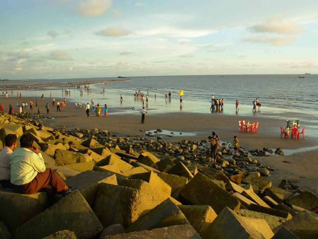
Patenga sits at the exact point the Karnaphuli empties into the Bay of Bengal, giving it a mix of river traffic and open sea in one view. The beach draws its biggest crowds at sunset, when fast skiffs cross the water and vendors sell snacks and grilled corn along the sand. Marine Drive, a short coastal road from the beach, adds port views and a quieter walk away from the main crowd. The Bangladesh Navy maintains a nearby base, and small naval monuments sit along parts of the shoreline. Local families often bring badminton nets and cricket bats for informal games on the wider sections of sand once the tide pulls back.
2. Foy's Lake:
An artificial lake built in 1924 by the Assam Bengal Railway
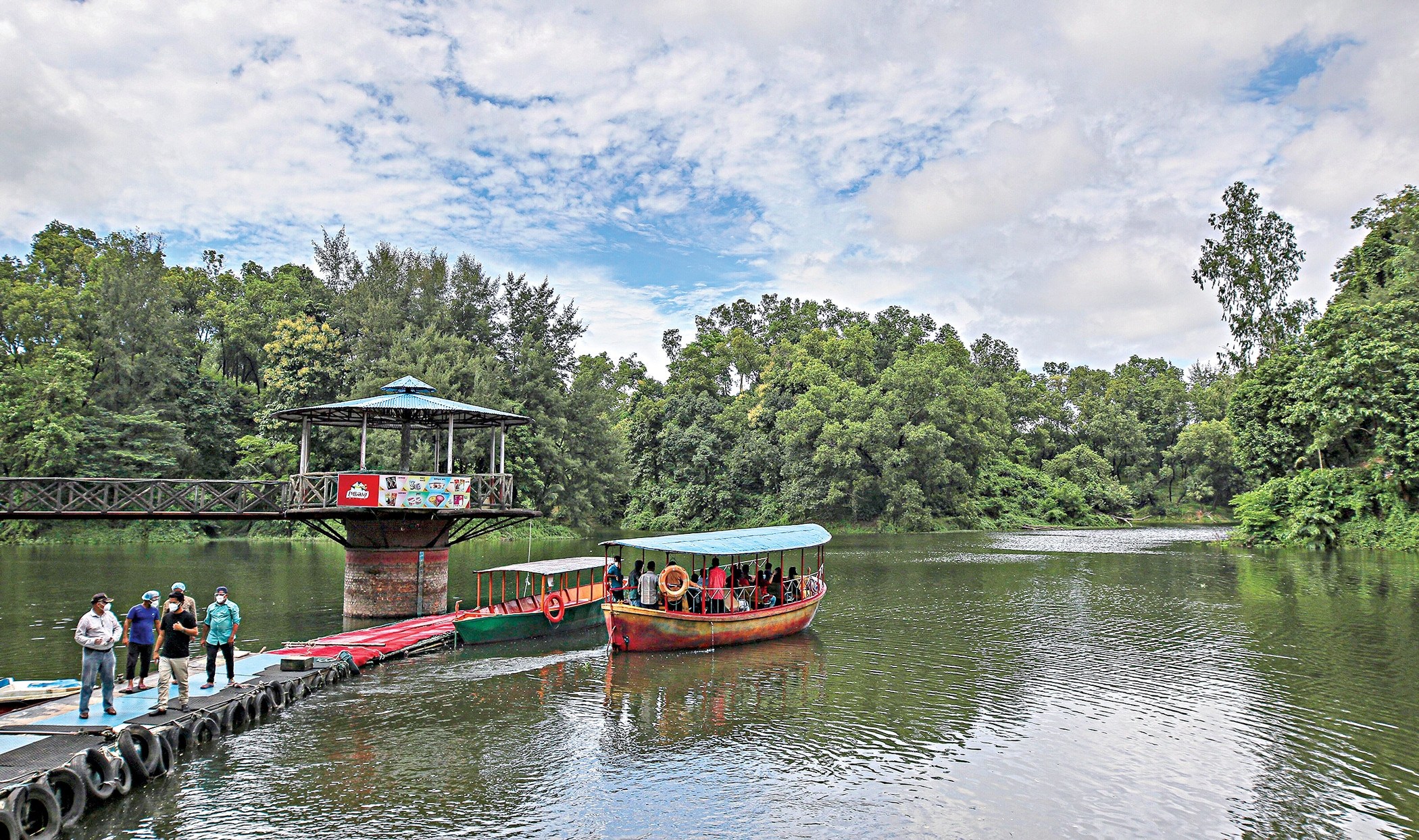
The Assam Bengal Railway built Foy's Lake in 1924 as a water reservoir for its steam engines, and the surrounding hills turned it into one of the city's main recreational spots. Concord Sea World, a water park, and Foy's Lake Amusement Park now share the grounds, alongside paddle boats and lakeside restaurants serving fish curry and biryani. The lake covers roughly 336 acres inside a protected green belt the railway originally cordoned off from surrounding development. A cable car briefly operated across the water in past years, though boat rides remain the standard way to see the lake up close today.
3. Shrine of Bayazid Bostami:
A Sufi shrine in Nasirabad, with a pond of tame crocodiles
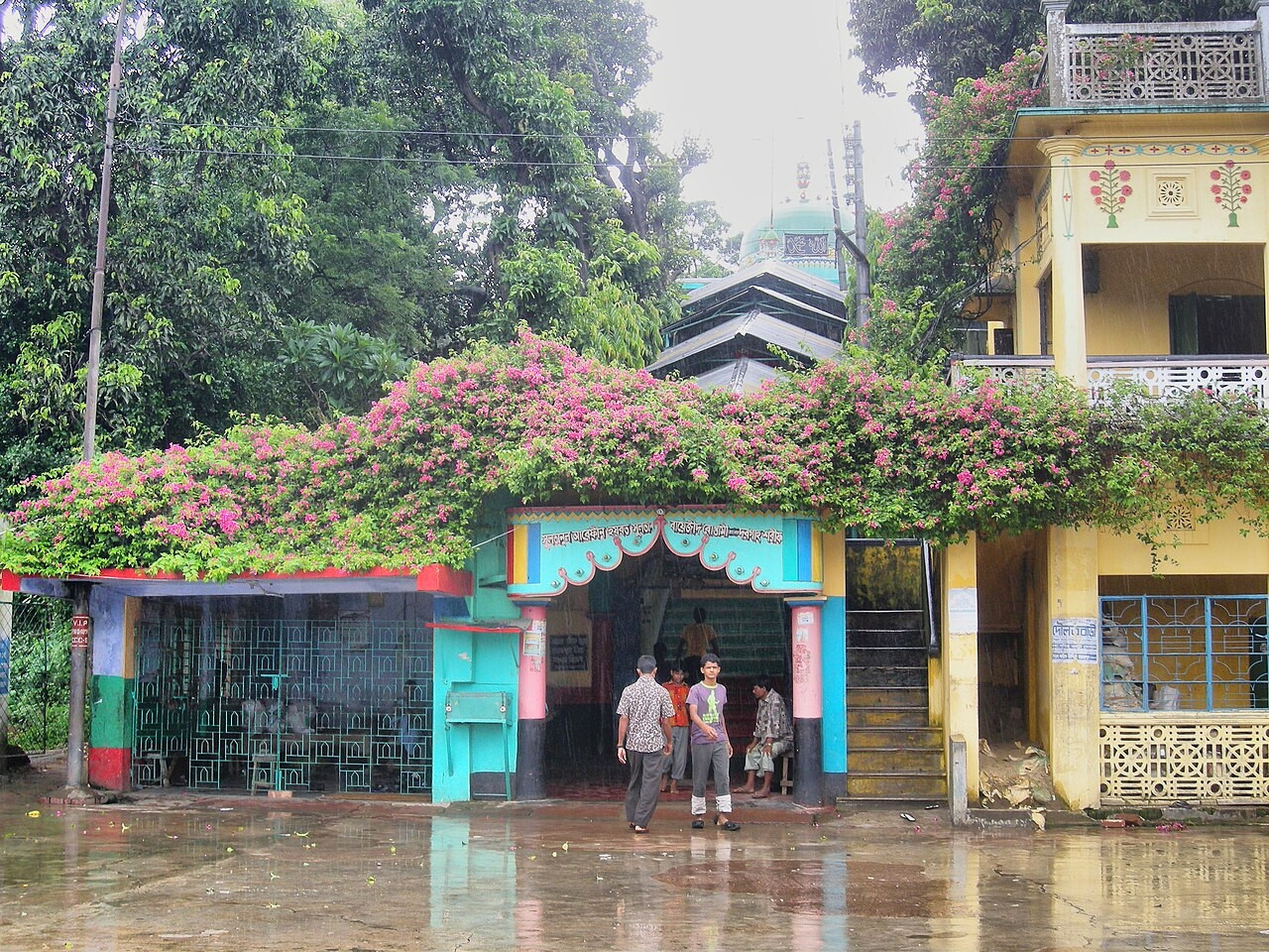
The shrine honors the Persian Sufi saint Bayazid Bostami and draws pilgrims from both Muslim and Hindu communities, an unusual shared devotional site by regional standards. A pond on the grounds has held tame crocodiles for generations, considered sacred by many visitors. The site sits inside a residential neighborhood, not a dedicated tourist zone, which gives it a genuinely local, unstaged atmosphere. Historical records connect the shrine to a period of Sufi missionary activity in the Chittagong region centuries ago, though scholars debate exactly when the site took its current form. Local vendors near the entrance sell fish specifically for visitors to feed to the crocodiles as an act of devotion.
4. Chittagong Commonwealth War Cemetery:
The resting place of over 1,600 Allied soldiers from World War II
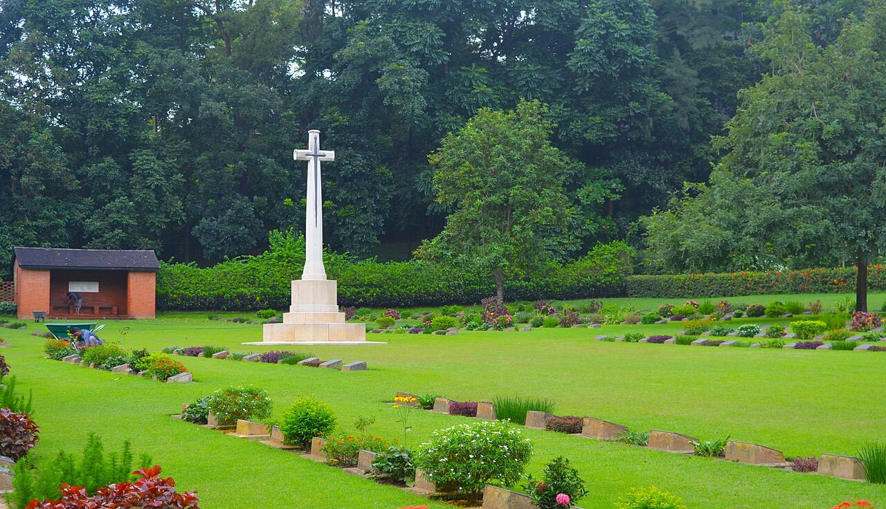
The Commonwealth War Graves Commission maintains this cemetery, holding more than 1,600 Allied soldiers who died during the Burma Campaign. Rows of uniform white headstones sit across manicured lawns, a striking contrast to the density of the surrounding city, and the grounds stay quiet enough for genuine reflection. Most of those buried here died fighting Japanese forces during the 1943-1945 push through Burma, and the cemetery forms part of a network of CWGC sites scattered across South and Southeast Asia. Each headstone carries a name, rank, regiment, and date, maintained to a uniform standard regardless of rank.
5. Ethnological Museum:
Bangladesh's only dedicated museum of tribal and ethnic culture
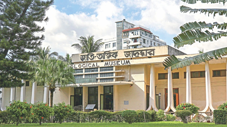
Located in Agrabad, this is the only ethnological museum in Bangladesh, built to document the country's tribal and ethnic communities, many concentrated in the Chittagong Hill Tracts. The main gallery displays traditional costumes, jewelry, and textiles from the Chakma, Marma, and Tripura peoples, alongside pottery, basketry, and metalwork. A second gallery covers Bangladesh's broader ancient and medieval history. The museum opened in 1965 and has since expanded its collection through donations from anthropologists and government agencies working across the hill districts. A small library attached to the museum holds academic papers on Bangladesh's indigenous groups, useful for anyone researching beyond what the display cases show.
6. Shah Amanat Shrine (Laldighi):
One of the city's most visited mausoleum complexes
The shrine complex at Laldighi draws daily ziyarat visits and a steady flow of vendors around its perimeter. Chittagong's Shah Amanat International Airport takes its name directly from the saint honored here, a sign of how central the shrine sits in the city's identity. Laldighi, the pond the neighborhood takes its name from, adds an open public space nearby. Devotees leave offerings of flowers, sweets, and cloth at the tomb, and Thursday evenings typically draw the largest crowds of the week for collective prayer. The surrounding market lanes sell religious items, prayer caps, and tasbih beads alongside everyday goods.
7. Chittagong Fish Harbour and Market:
One of the country's largest fish markets, on the Karnaphuli
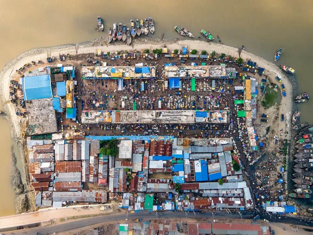
The fish harbour sits directly on the Karnaphuli River, where local fishing boats unload their daily catch into one of Bangladesh's largest seafood markets. Hilsa, the country's most prized fish, moves through here in volume. Traditional wooden fishing boats line the riverbank, and early morning, before 8am, is when the market runs at full intensity. Auctioneers call out prices in rapid succession as buyers, mostly restaurant owners and wholesalers, bid on crates fresh off the boats. Ice blocks get broken down on site to pack the catch for transport further inland, a process that runs continuously through the busiest morning hours.
8. Zia Memorial Museum (Chittagong Circuit House):
A British colonial-era residence turned historical museum
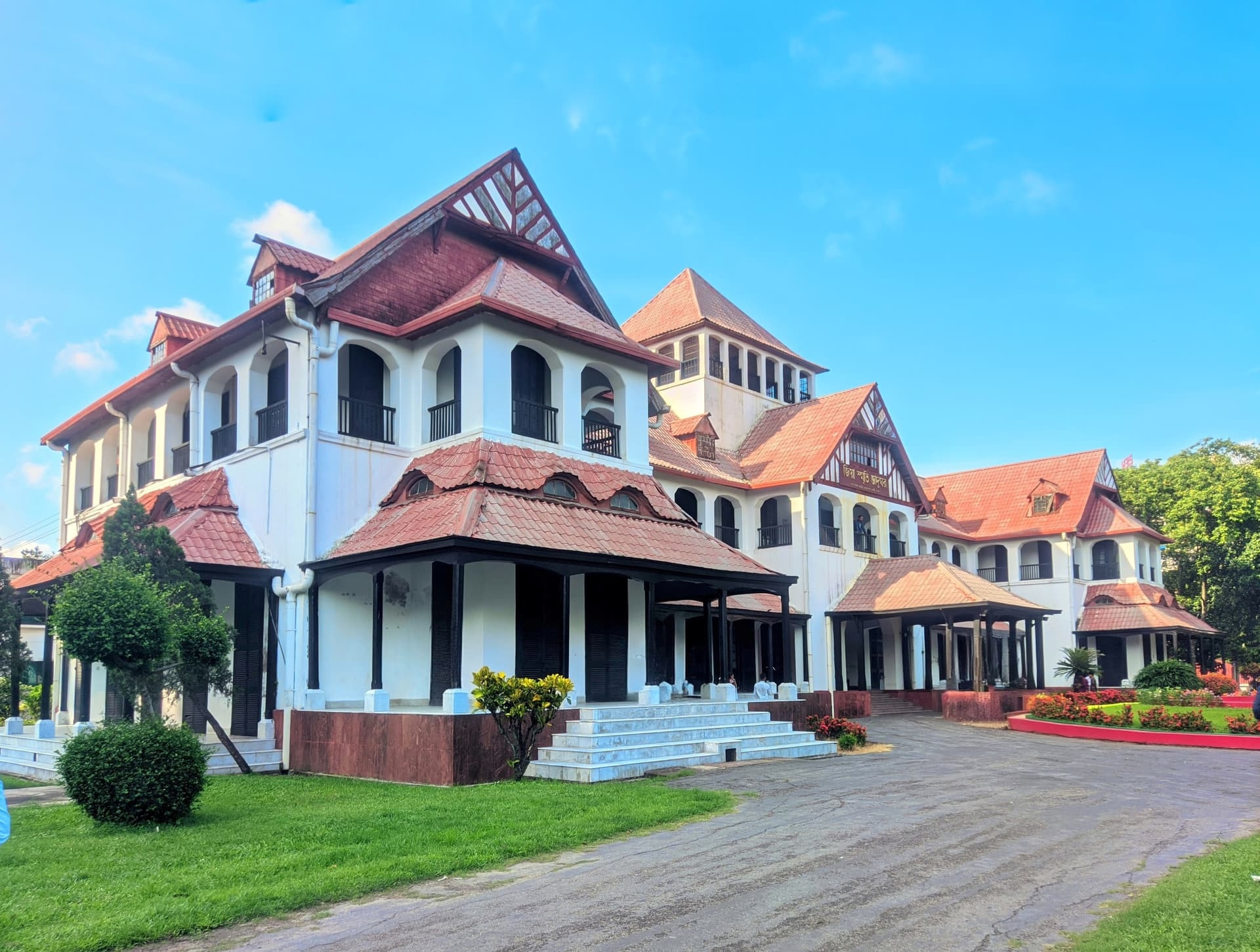
Built in the early 20th century as a residence for British colonial officials, the Circuit House later became notable as the site connected to President Ziaur Rahman and now operates as a museum covering his life and Bangladesh's political history. Landscaped gardens with a small lake surround the building. Exhibits inside trace Ziaur Rahman's military career, his role in the 1971 Liberation War, and his presidency before his assassination in Chittagong in 1981. Photographs, personal items, and government documents fill several rooms, alongside a timeline of Bangladesh's early political history.
9. Chandanpura Mosque:
An onion-domed landmark in the city center
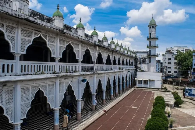
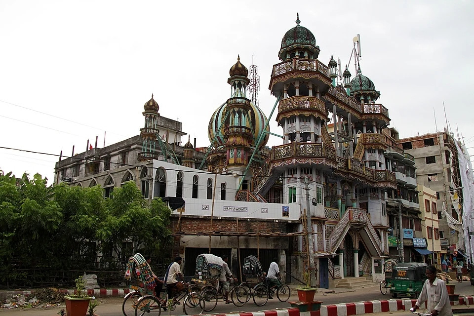
A striking mosque with an onion-style dome and ornate minarets, one of the most photographed religious buildings in central Chittagong. Its layered exterior work stands out against the surrounding concrete blocks of the older city. The mosque dates to the 1980s, built in a style that borrows visibly from Ottoman and Mughal architectural traditions instead of the simpler brick mosques common elsewhere in the city. Multiple minarets and a cluster of smaller domes surround the central dome, giving the building a denser silhouette than most religious structures in Chittagong.
10. Wali Khan Mosque:
One of the oldest mosques in Bangladesh
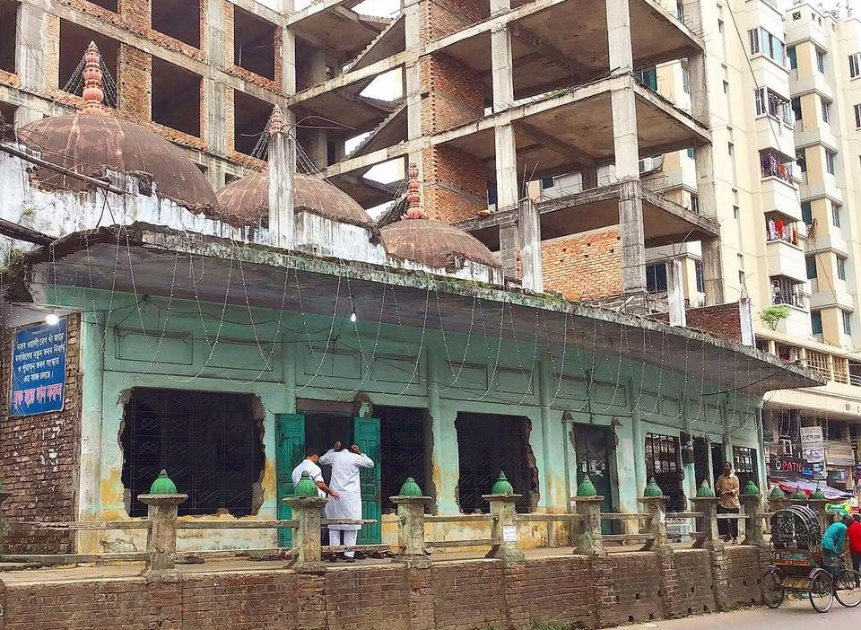
Sitting in the heart of the port city, Wali Khan Mosque carries a long, layered history tied to Chittagong's early Muslim community, and its worn stonework shows centuries of continuous use, not a restored facade. Local tradition traces the mosque's origins to the early Mughal period, when Chittagong first came under sustained Muslim administration after centuries of Buddhist and Hindu rule. The building has been renovated multiple times over the centuries, though its core structure and layout have stayed largely unchanged.
11. Chittagong Zoo:
A family-friendly city zoo
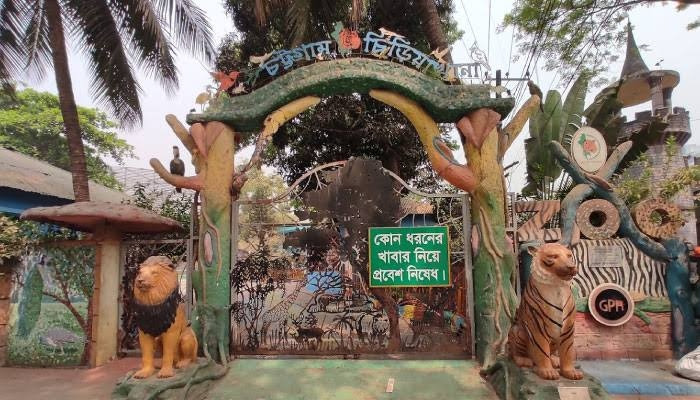
A straightforward stop for anyone traveling with children who want a break from museums and shrines, with a modest collection of native and exotic species set across shaded grounds. Enclosures house Bengal tigers, various deer species, and a range of native birds, alongside a small reptile section. The zoo sits on modest grounds by international standards, and most visits run 1-2 hours instead of a full day out. A small aquarium section was added in recent years, giving the zoo a bit more variety beyond its land animal enclosures.
12. Karnaphuli Shishu Park:
A green family park with a small theme-park section
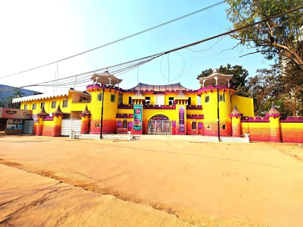
A common local weekend spot, not a tourist destination built for visitors specifically, with basic rides and open lawns that make it an easy stop between other sights. Small rides suited to younger children sit alongside open lawns where families spread mats for a picnic lunch. Vendors sell snacks, ice cream, and balloons near the entrance, and the park stays busiest on Friday afternoons, the weekly holiday in Bangladesh. Weekday visits run far quieter, useful for anyone wanting to avoid the Friday holiday crowds entirely.
13. University of Chittagong, Science Faculty Lake:
A quiet lake on the university's hilly, green campus
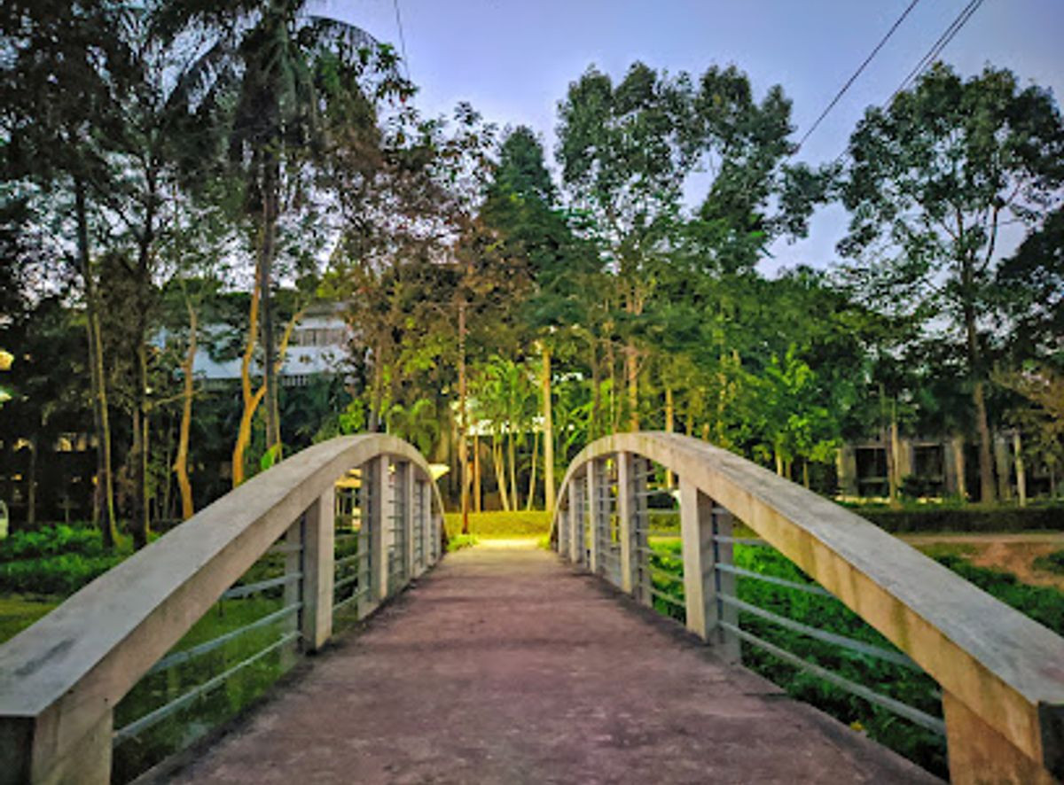
The University of Chittagong's campus rolls across wooded hills well outside the city center, and the small lake near the Science Faculty offers a peaceful stop if a slower campus walk fits the day's pace. Students use the surrounding paths for daily walks between classes, and the lake occasionally hosts small cultural events organized by student groups. The wider campus spans hundreds of acres of hill and forest, among the largest and greenest university campuses in the country. Shaded benches along the water make it a popular spot for students studying between lectures during exam season.
14. Nazrul Square (DC Hill):
A hilltop park with panoramic city views
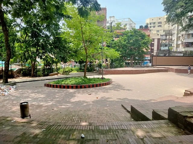
Named for poet Kazi Nazrul Islam, this central hilltop park gives one of the more accessible elevated views over the city, without the drive time a proper hill destination requires. The park takes its name from the Deputy Commissioner's office once located nearby, though locals and signage now favor Nazrul Square, honoring the poet's connection to the city. Benches line the paths near the summit, a common spot for evening walks once the day's heat breaks. The climb itself is short and paved, manageable for most visitors regardless of fitness level or age.
15. Cafe 24:
A large park built around a pond, with short boat rides
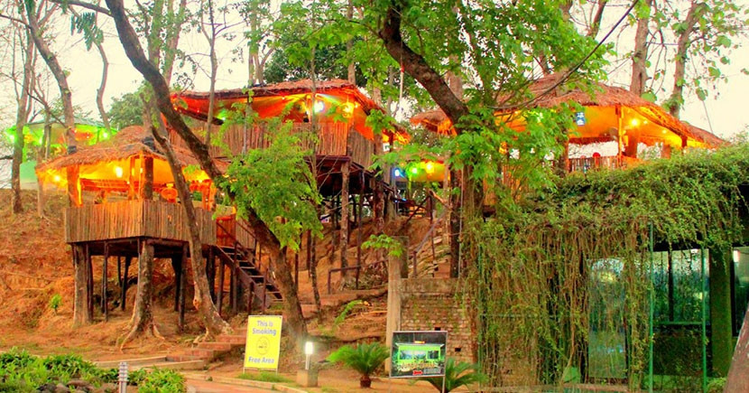
A low-key, inexpensive stop for photos and a slow walk, popular with local families for weekend picnics and an easy boat ride around the pond. Vendors around the park sell tea, fried snacks, and fresh coconut water, and the pond stays stocked for casual fishing by permit in certain sections. Families often treat it as a shorter, cheaper alternative to Foy's Lake for an afternoon out. It draws a steady stream of local visitors, not international tourists, giving it a genuinely everyday, unpolished feel.
16. Bhatiary Golf and Country Club:
A golf course set into the hills, roughly 20 km north
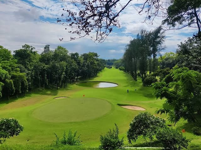
The course sits in genuine hill terrain north of the city, with Bhatiary Lake nearby for kayaking and birdwatching, one of the more scenic escapes close to Chittagong. The Bangladesh Army manages the course, and its hilly layout gives it a distinctly different character from the flatter municipal courses found elsewhere in the country. Membership and guest access both run through the army's own booking channels, not a public tourism office. The setting draws a mix of military personnel, expatriates, and local golf enthusiasts on any given weekend.
17. Sunset Point, Bhatiari:
A hillside viewpoint timed for late-afternoon light
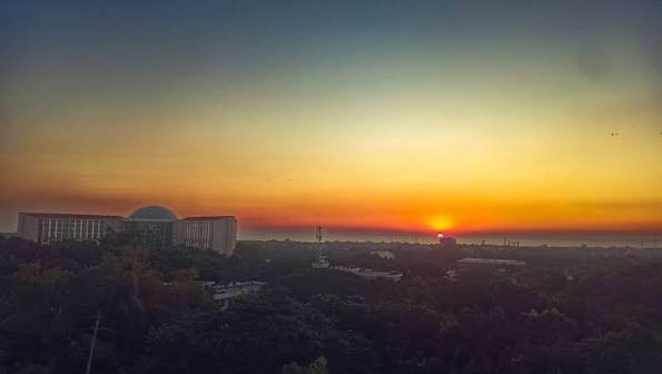
Quiet enough for a genuine escape from the city, this viewpoint pairs well with the golf course and Falls 24 as part of the same half-day trip north. Local vendors set up simple tea stalls near the viewpoint in the late afternoon, catering to the small but steady stream of visitors who come specifically for the sunset. The surrounding hills stay noticeably cooler than the coastal flats of the city below. Few formal facilities exist here, so most visitors treat it as a brief stop, not a destination to linger at for hours.
18. Falls 24:
A cascading waterfall in the Bhatiary hills
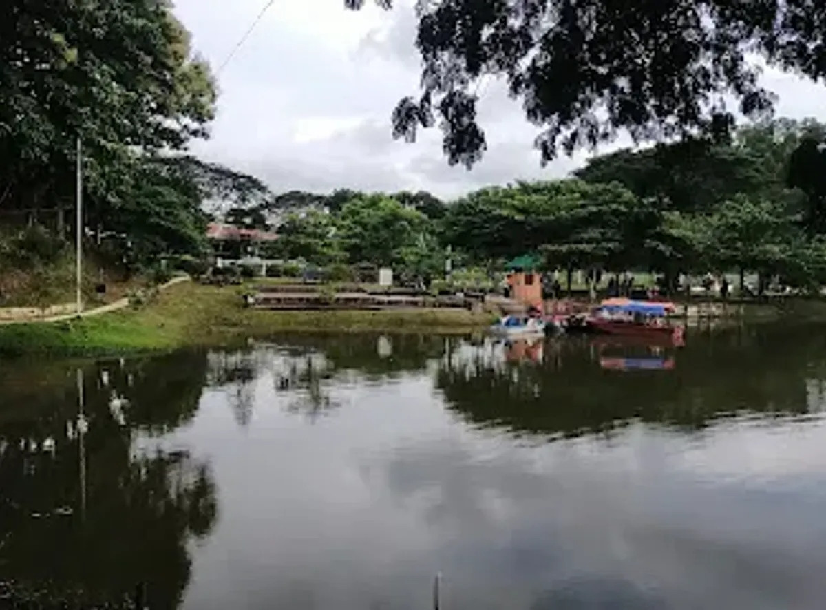
Reachable as part of the same day trip as the golf course and Sunset Point, the falls run best in the months just after the monsoon when water flow is still strong. The name reportedly comes from the 24 distinct pools formed along the falls' descent, though the exact count depends on water level and season. A short, unpaved trail leads from the road to the base of the falls, manageable in ordinary walking shoes during the dry months. Local guides sometimes wait near the entrance offering to lead visitors along the safest route through the rocks.
19. Mini Bangladesh (Shadhinota Complex):
A theme park recreating Bangladesh's landmarks in miniature
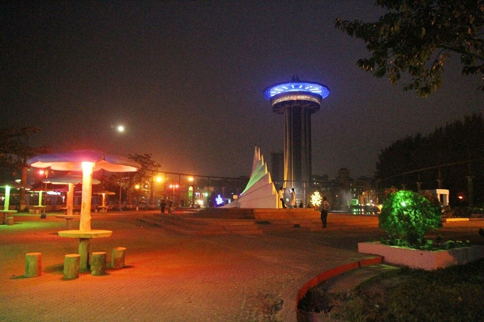
Alongside the scaled-down landmarks, the complex includes cultural exhibits tied to the country's independence history, a straightforward family stop on the city's outskirts. Scaled models recreate landmarks including the Shaheed Minar, the National Parliament building, and several Mughal-era monuments from around the country, letting visitors see structures from Dhaka, Rajshahi, and elsewhere without traveling to each site individually. Informational plaques accompany each model with basic historical context. The complex works especially well for children too young for a longer, more demanding regional trip.
20. Chittagong Port:
Bangladesh's main seaport
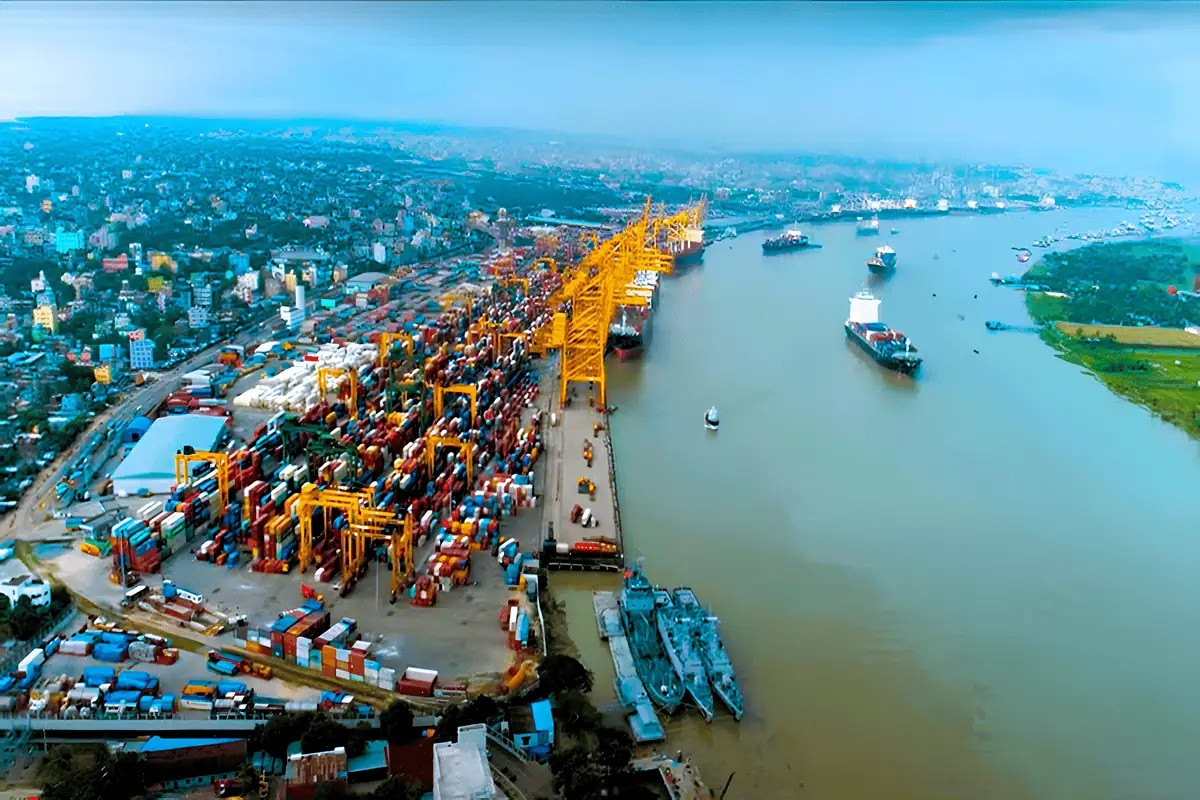
A genuine working economic hub, not a curated attraction. Guided tours occasionally run to see cargo ships and container operations up close, best arranged in advance through a local operator. Handling the majority of Bangladesh's international trade by volume, the port operates multiple terminals along the Karnaphuli River and connects to a rail and highway network reaching the rest of the country. Container ships from major shipping lines dock here daily, a scale of operation visible even from a distance.
21-24: Rangamati:
Rangamati sits 2-3 hours from Chittagong city by road and centers almost entirely on Kaptai Lake.
21. Kaptai Lake:
Bangladesh's largest man-made lake, formed by a 1960s hydroelectric project
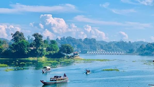
Kaptai Lake formed in the 1960s when a hydroelectric dam project flooded the Karnaphuli valley, and it remains the largest artificial lake in the country. Boat rides across the lake pass hilly, forested shoreline dotted with small Chakma villages. The dam that created the lake displaced tens of thousands of Chakma residents in the 1960s, a historical event still referenced in local accounts of the region's more recent political tensions. Today the lake supports fishing, hydroelectric power generation, and a steady tourism economy built around boat tours.
22. Rangamati Hanging Bridge:
Rangamati's most photographed landmark
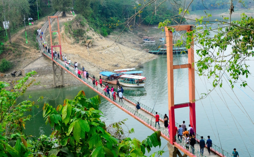
A suspension footbridge over an arm of Kaptai Lake, and the single most recognizable image associated with Rangamati in Bangladeshi travel content. The walk across gives an open view of the lake in both directions. Built primarily as a pedestrian and light-traffic crossing, the bridge connects 2 sections of Rangamati separated by an inlet of the lake, saving a considerably longer boat or road detour for local residents. Its cable-supported design sways slightly underfoot, part of what makes it a memorable walk for first-time visitors.
23. Rajban Bihar:
A prominent Buddhist temple complex on the lake
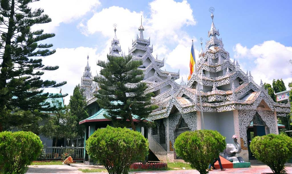
The main Buddhist monastery in Rangamati, reachable by boat, with a peaceful lakeside setting that reflects the region's significant Chakma and Marma Buddhist population. Orange-robed monks maintain daily rituals here, and the temple hosts larger gatherings during Buddhist festivals throughout the year, drawing worshippers from across the surrounding hill districts. Gilded statues and painted murals inside the main hall depict scenes from the life of the Buddha. Visitors typically combine the temple stop with a longer boat tour covering several points around the lake in one outing.
24. Peda Ting Ting:
A floating restaurant on Kaptai Lake
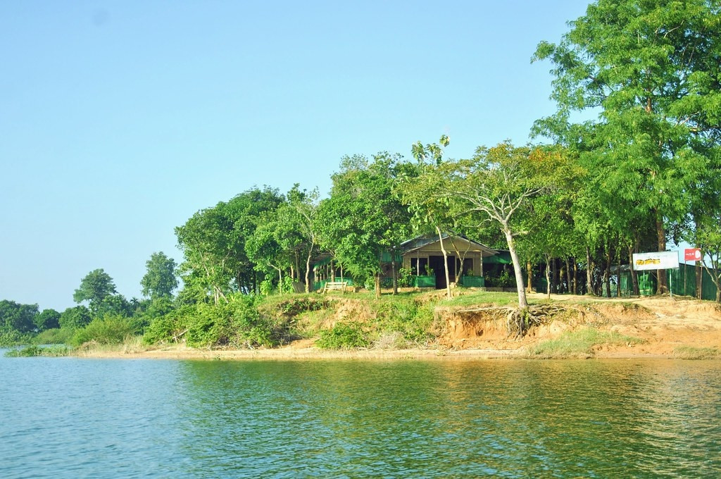
A restaurant built on the water itself, serving regional dishes with a view over the lake, reachable only by boat and a common stop on a half-day Kaptai Lake tour. The restaurant's name comes from the local Chakma language, and its menu leans heavily on freshwater fish caught directly from the lake alongside regional bamboo shoot and vegetable dishes. Seating areas built on stilts over the water give diners an unobstructed view in every direction. Advance booking matters most during winter weekends, when tour groups often reserve the entire floating dining area ahead of time.
25-28: Bandarban:
Bandarban rewards more time than Rangamati, with winding mountain roads leading to the country's highest accessible viewpoints.
25. Nilgiri:
A hilltop viewpoint around 2,000-3,500 feet up, nicknamed the "Darjeeling of Bangladesh"
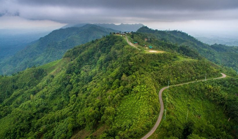
Nilgiri sits on the Bandarban-Thanchi road, roughly 45-52 km from Bandarban town, high enough that clouds regularly roll below the viewpoint instead of above it. The Bangladesh Army runs a small resort here with a handful of cottages. On clear days, visitors report seeing as far as Cox's Bazar's coastline and the lights of Chittagong port. The Bangladesh Army opened the site to tourism gradually after its original use as a security outpost during regional road construction, and its 3 named cottages, Akashnila, Meghdut, and Nilatana, book out well in advance during peak winter weekends.
26. Chimbuk Hill:
A major stop on the road between Bandarban town and Nilgiri
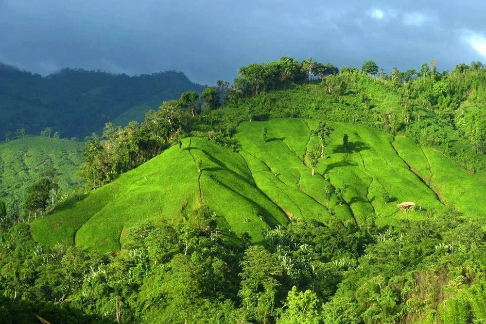
Chimbuk sits along the same winding road that leads toward Nilgiri and Thanchi, and its viewpoint gives sweeping views over the surrounding hill ranges. Several Mro and Bawm ethnic communities live in villages nearby. Local Mro communities sell handwoven textiles and small handicrafts to passing visitors near the viewpoint, one of the more accessible points of contact between tourists and the region's ethnic minority groups. The hill sits at a lower elevation than Nilgiri, making it a shorter, easier stop for anyone short on time.
27. Boga Lake:
Bangladesh's highest natural lake, roughly 3,000 feet up
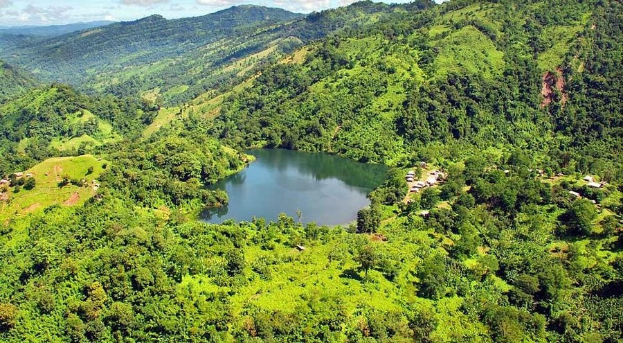
Boga Lake sits about 15 km from Ruma Upazila and covers around 15 acres atop a hill, a genuine natural rarity, not a man-made reservoir. Local legend attributes the lake's origin to various supernatural explanations, and a handful of small ethnic communities live nearby. A rest house built by the Bandarban Hill District Council allows overnight stays. The lake's water level and color shift subtly with the season, and locals maintain that its depth has never been fully measured, part of the mystery surrounding its origin story. Trekkers heading toward Keokradong typically spend a night at Boga Lake's rest house before continuing the following morning.
28. Nafakhum Waterfall:
Often described as Bangladesh's largest waterfall, near Remakri
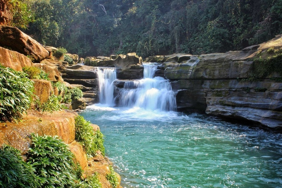
Reaching Nafakhum requires a boat ride up the Sangu River from Thanchi to Remakri, followed by a trek on foot, making it one of the more physically demanding destinations in this guide. The reward is a wide, powerful cascade over a rocky riverbed, most dramatic in the months right after the monsoon. Local Marma communities living along the Sangu River route often act as boat operators and guides for the journey, and the trek itself crosses several smaller streams before reaching the main falls. Few foreign tourists make it this far given the permit requirements and physical demands involved.
29-31: Khagrachari:
Khagrachari sits further from Chittagong city than Rangamati or Bandarban, and Sajek Valley, technically inside Rangamati district, is usually reached through Khagrachari's roads.
29. Alutila Cave:
A natural limestone cave requiring a torch or bamboo torch to explore
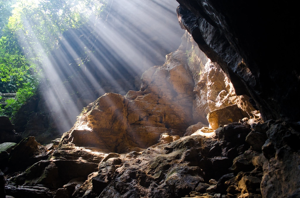
The cave runs dark and narrow enough that most visitors rent a bamboo torch from vendors at the entrance instead of attempting it with just a phone flashlight. A hilltop viewpoint above the cave gives a wide view over the surrounding Khagrachari valley. Local legend holds that the cave was discovered by a hunter chasing a wild boar, and the passage narrows enough in places that larger visitors may need to crouch. The full walk-through takes roughly 15-20 minutes at a careful pace.
30. Risang Waterfall:
A 2-tiered waterfall accessible by a steep staircase
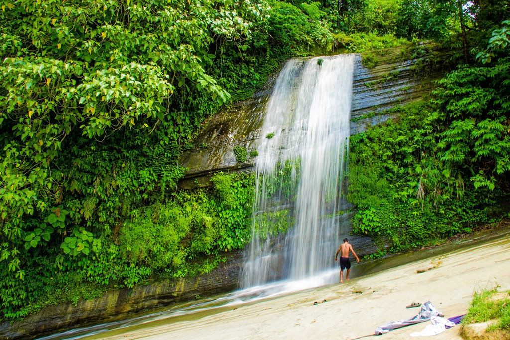
Risang drops in 2 distinct stages down a rock face, and a long staircase built into the hillside makes the descent manageable without technical trekking gear, unlike several of Bandarban's more remote falls. The falls run fullest during and just after the monsoon, dropping to a much thinner trickle by the height of the dry season in February and March. A small tea stall near the base serves visitors making the climb back up. Local vendors near the base sell fried snacks and cold drinks for the walk back up the staircase.
31. Sajek Valley:
Known locally as the "Queen of Hills," with a cloud-sea effect at dawn
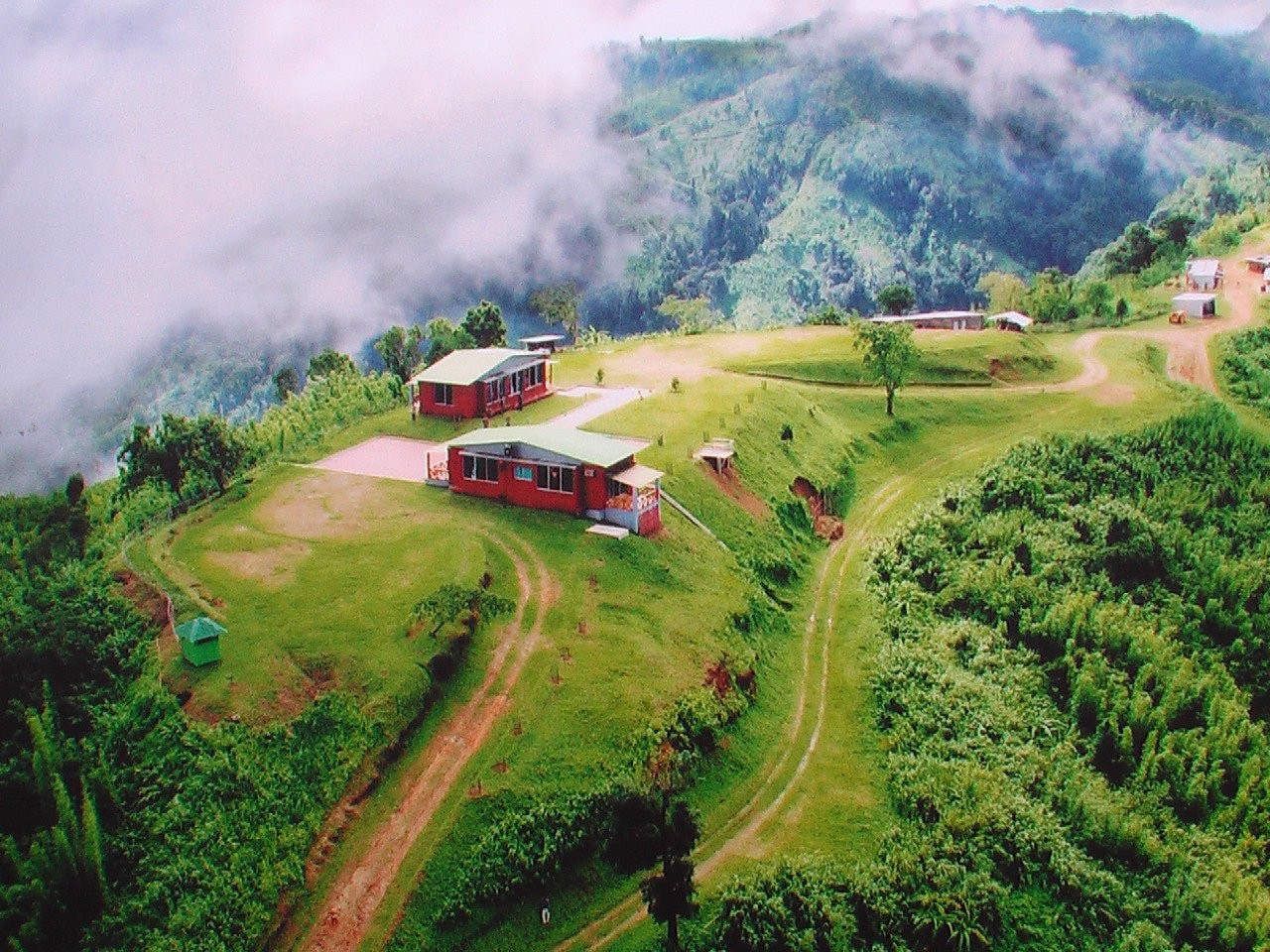
Sajek sits high enough that clouds settle into the valleys below the ridge-top village at dawn, a genuine sea-of-clouds effect that's become one of the most Instagrammed scenes in Bangladeshi travel content. Resort cottages line the ridge, and the drive up requires an armed escort convoy system at set departure times, a security measure that's been standard practice for tourist vehicles for years. Congo Dighi, a small crater lake near the village, adds a second stop for visitors who want more than the ridge-top viewpoints, and several resorts now offer bonfire evenings with local Tripura and Lushai cultural performances.
32-40: Cox's Bazar:
Cox's Bazar needs its own multi-day trip; these 9 spots cover the beach itself, nearby parks, and the offshore islands.
32. Cox's Bazar Beach:
Over 120 km of unbroken sand, among the longest natural sea beaches in the world
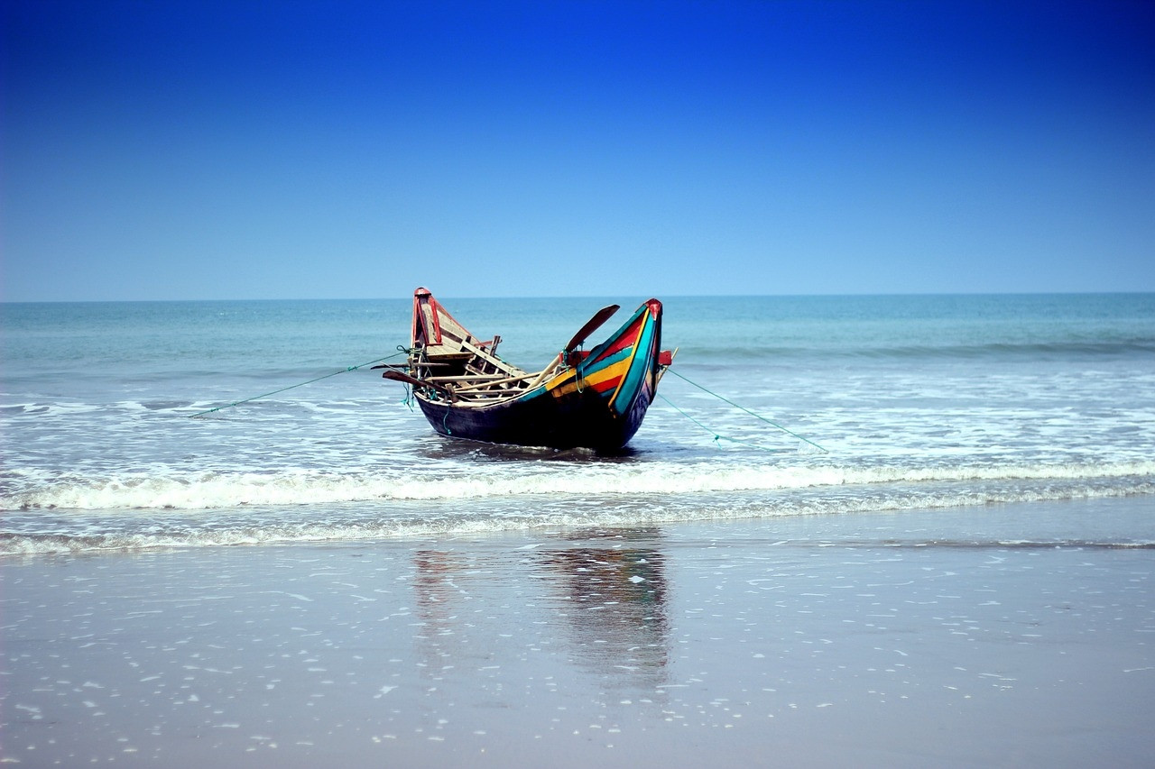
Cox's Bazar's beach runs long enough to feel genuinely uncrowded away from the 2 main developed stretches, Laboni and Kolatoli. At high tide the beach narrows to about 200 meters wide; at low tide it widens to roughly 400 meters. Parasailing and jet-ski rentals cluster around the main beach entrances. Beach vendors sell fresh grilled fish, tea, and boiled corn along the main stretches, and horse rides are a common sight for families with young children. Lifeguard coverage remains limited compared to beaches in more developed tourism markets, so swimmers should stay within marked safe zones.
33. Himchari National Park:
Waterfalls and hill views a short drive south of Cox's Bazar
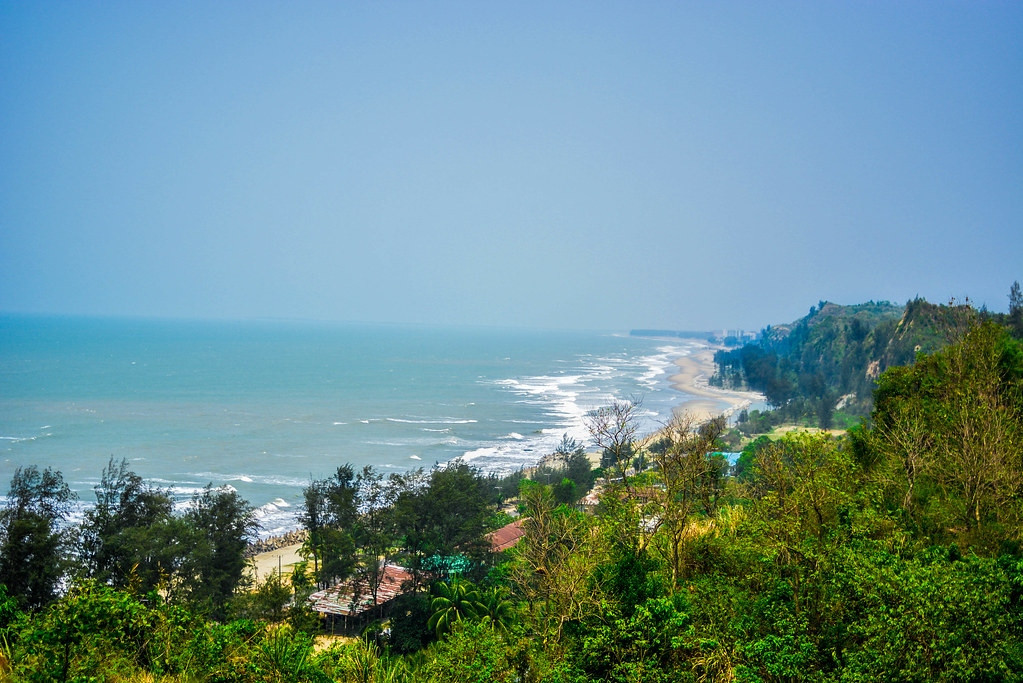
Himchari's small waterfall runs best just after monsoon season, and the park's hilltop viewpoint gives a long, uninterrupted look down the coastline toward Inani. Declared a national park to protect the area's remaining forest cover, Himchari also sits along what was once part of the region's elephant corridor, though sightings are rare given how much habitat has shrunk in recent decades. The drive from Cox's Bazar hugs the coastline the entire way. A small forest checkpoint near the entrance sometimes restricts access during periods of heavy rainfall for safety reasons.
34. Inani Beach:
A quieter, cleaner stretch of coast south of the main Cox's Bazar strip
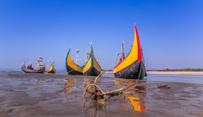
Coral fragments scatter across parts of the sand here, a detail that sets it apart from the main Cox's Bazar beaches, and the water runs noticeably cleaner given the distance from the main tourist strip. A cluster of upscale resorts has developed around Inani in recent years, drawing visitors specifically seeking a quieter alternative to the crowded main Cox's Bazar strip. Rock formations exposed at low tide add a different texture to the shoreline than the flat sand found elsewhere along the coast.
35. St. Martin's Island:
Bangladesh's only coral island, and its southernmost point
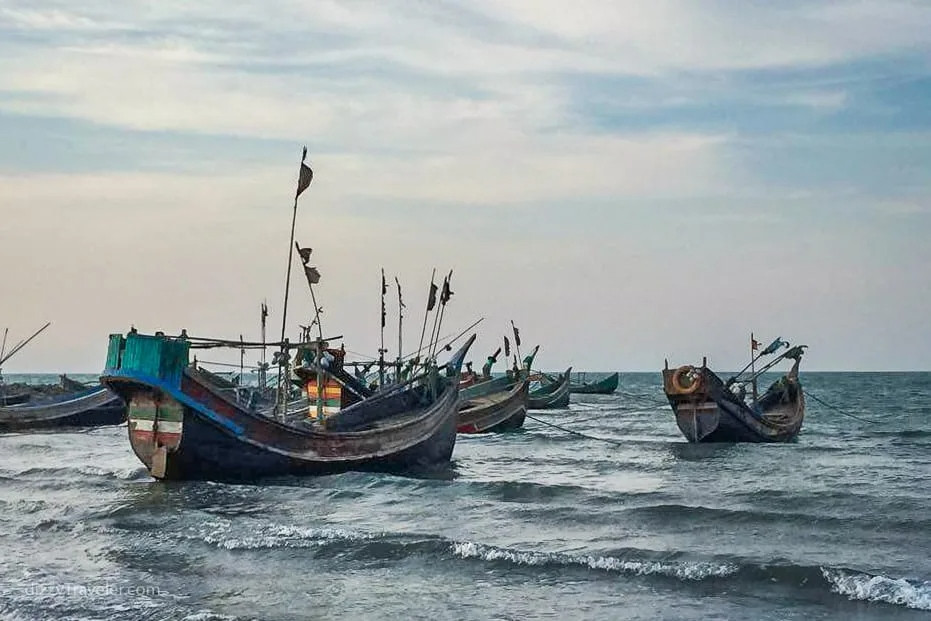
St. Martin's runs about 7.3 km long and sits roughly 9 km off the Cox's Bazar-Teknaf peninsula, close enough to Myanmar that the island counts as the country's southernmost territory. Around 3,700 people live here, mostly fishing families. Tourist boats generally run only November through February, since rough seas make the crossing unsafe the rest of the year. Coral reefs surround parts of the island, though pollution and unregulated tourism have visibly damaged sections in recent years, prompting periodic government restrictions on visitor numbers. A narrow strip called Chera Dwip separates at high tide, technically forming a second, smaller island.
36. Moheshkhali Island:
A short boat ride from Cox's Bazar, known for the Adinath Temple
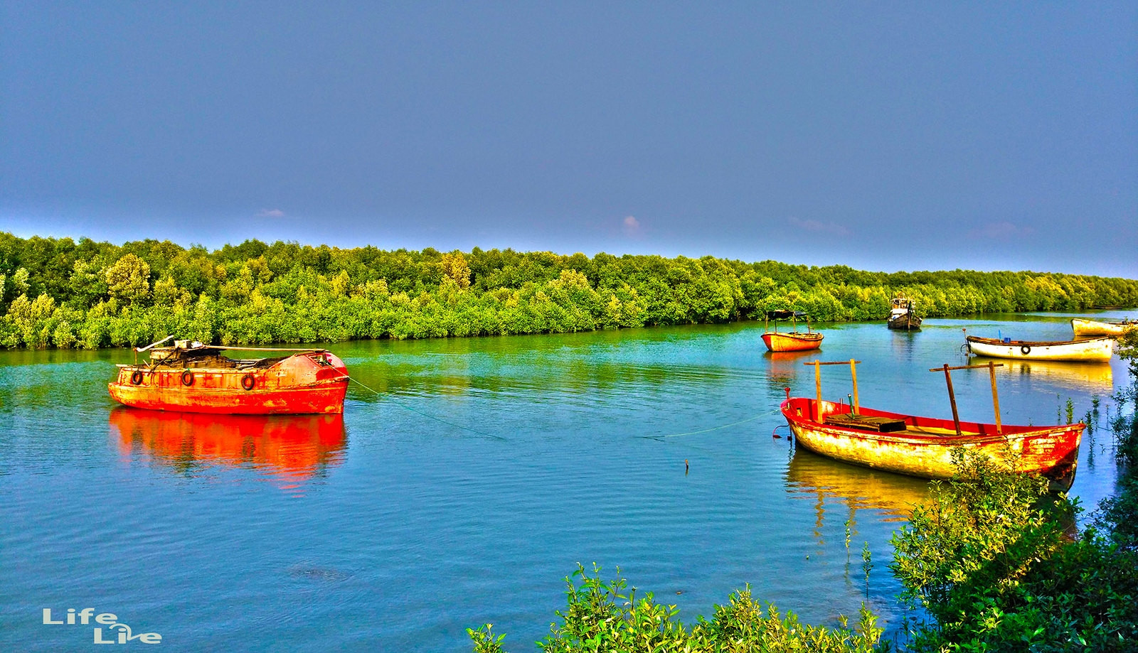
Moheshkhali sits close enough to Cox's Bazar for a half-day trip, centered on the hilltop Adinath Temple, a significant Hindu pilgrimage site, and betel leaf farms that supply much of the region. Pilgrims climb a long staircase to reach the temple at the hilltop, and the island's economy runs heavily on salt production and dried fish alongside its betel leaf farms. A narrow channel separates Moheshkhali from the mainland, crossed by small motorized boats running throughout the day. The island stays noticeably quieter than Cox's Bazar itself, a genuine contrast for anyone wanting a slower half-day out.
37. Ramu:
A cluster of historic Buddhist temples near Cox's Bazar
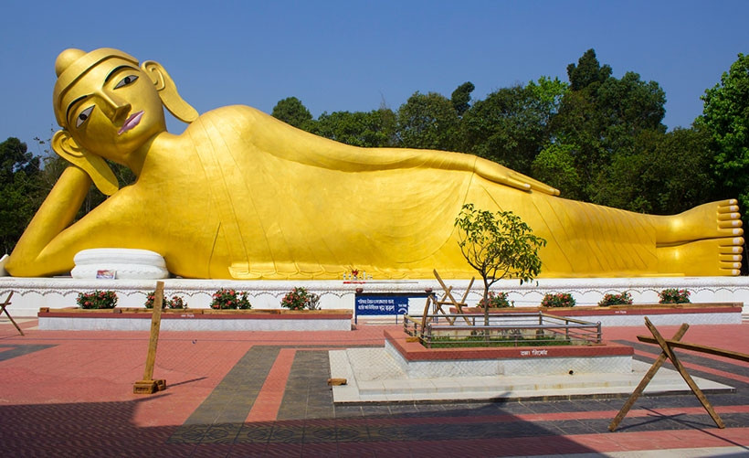
Ramu holds some of the oldest Buddhist temples and monasteries in the region, a quieter cultural stop for anyone spending more than a couple of days around Cox's Bazar. The area suffered significant damage during communal violence in 2012 that destroyed several historic temples, since rebuilt with support from the government and international Buddhist organizations. Ramu remains home to one of the largest ethnic Rakhine Buddhist populations in Bangladesh. A visit here works well paired with Cox's Bazar, since the drive between the two takes well under an hour.
38. Teknaf:
Bangladesh's southernmost mainland point, on the Naf River
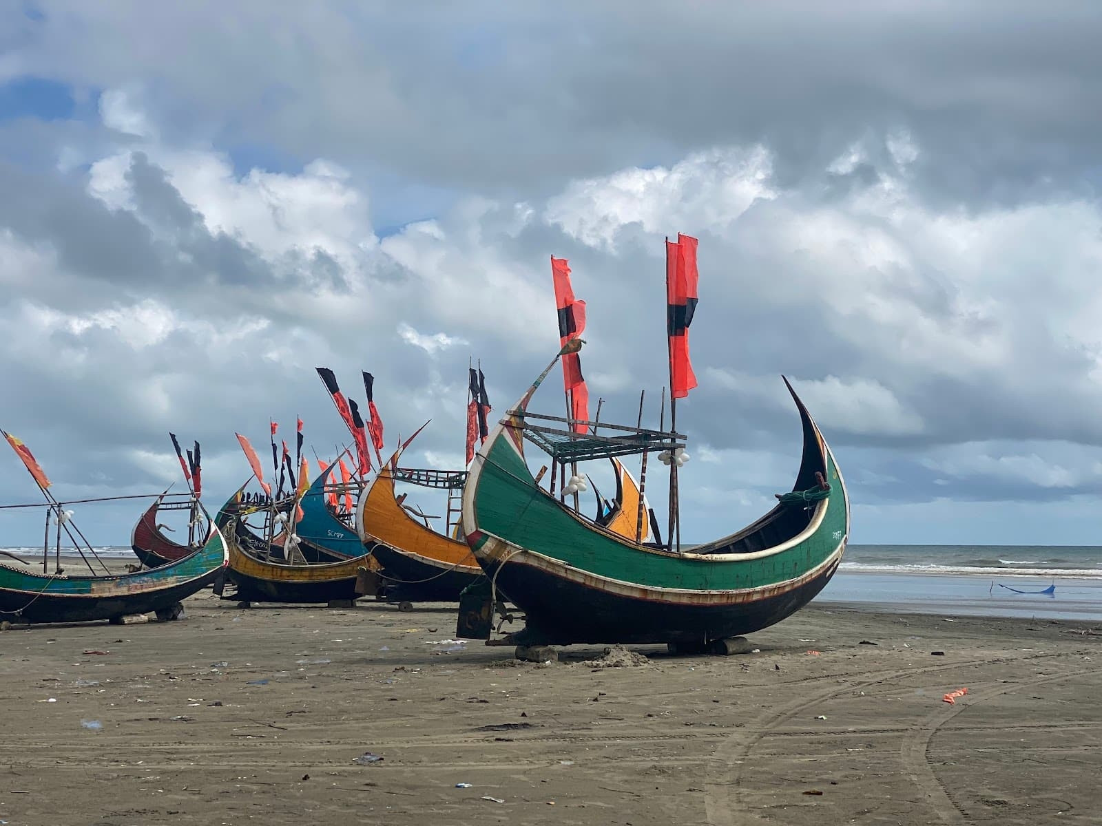
Teknaf marks the end of the mainland coast road and the departure point for St. Martin's Island boats, with views across the Naf River toward Myanmar. The town sits at the end of the Marine Drive coastal highway connecting it to Cox's Bazar, and its market serves as a supply point for fishing communities along the Naf River. Border security maintains a visible presence given Teknaf's position directly across from Myanmar. Most travelers pass through quickly on their way to or from the island, not staying overnight in the town itself.
39. Guliakhali Sea Beach:
A less-visited beach near Sitakunda, roughly 40 km north of Chittagong city
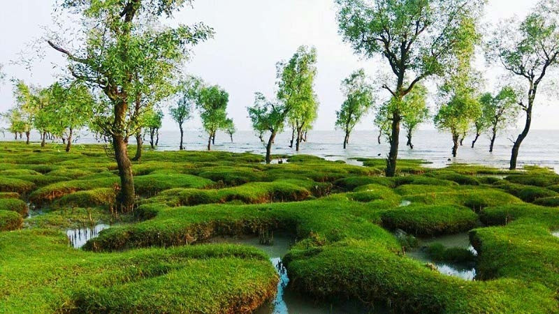
Guliakhali runs a genuinely different look from the main Cox's Bazar or Patenga stretches: green algae-covered rocks and mudflats create a striking, less conventional coastal scene, best photographed near low tide. The beach's algae-covered rocks turn a vivid green during the cooler months, fading as temperatures rise later in the year, which is why winter photography trips here have become popular among local photographers. Few facilities exist on site, so visitors typically bring their own food and water. The walk from the main road to the beach itself takes about 10-15 minutes across open farmland.
40. Khoiyachora Waterfall:
A multi-tiered waterfall in the Sitakunda hills
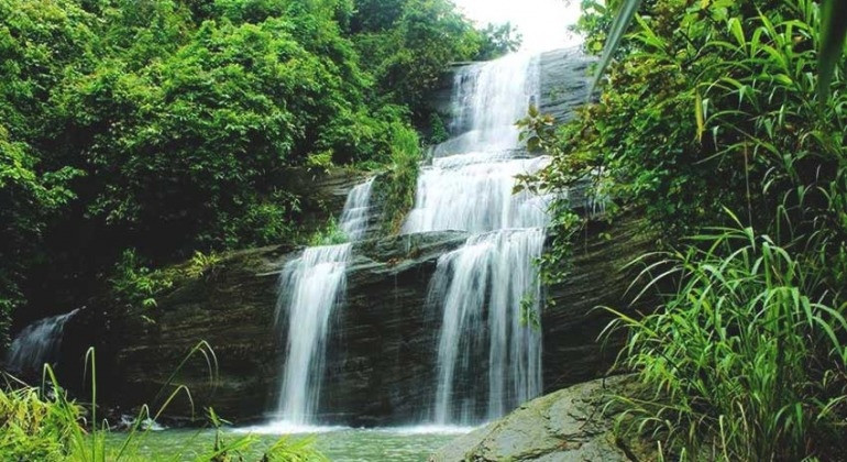
Considered one of the more scenic waterfalls near Chittagong, Khoiyachora runs down a series of rock steps and pairs well with a Chandranath Hill trip on the same Sitakunda day out from the city. Reaching the falls involves wading through a shallow stream bed for part of the route, making sturdy sandals a better choice than regular sneakers. The waterfall's flow varies noticeably by season, running strongest in the months immediately following the monsoon. Local guides are available near the trailhead for visitors unfamiliar with the route through the stream bed.
3-Day Itinerary for Chittagong City:
This covers Chittagong city and its closest day trip. Rangamati, Bandarban, Khagrachari, and Cox's Bazar each need their own separate trip beyond these 3 days.
🗓️ 3 days in and around Chittagong city
Where to Stay:
Chittagong city holds most of the useful accommodation; Rangamati, Bandarban, and Cox's Bazar each need separate bookings if you're continuing beyond the city.
Agrabad commercial area
The city's main business district holds most of the international-standard hotels, close to the Ethnological Museum and a central base for reaching most city sights by CNG.
GEC Circle and Nasirabad
Closer to Bayazid Bostami Shrine and Foy's Lake, with a wider range of budget and mid-range guesthouses than Agrabad.
Near Patenga Beach
Fewer options than the city center, but useful for anyone prioritizing sunrise or sunset access to the beach without a daily commute.
Rangamati town
Government-run Parjatan motels and private guesthouses cluster near the lake, useful as a base for Kaptai Lake and the Hanging Bridge.
Bandarban town
The practical base for day trips to Chimbuk, Nilgiri, and Boga Lake, with far more room and food options than staying overnight at the remote sites themselves.
Kolatoli and Laboni beach areas
Cox's Bazar's 2 main developed beach strips hold the widest hotel selection in the region, from budget guesthouses to beachfront resorts.
10 Practical Tips:
Fly if time is limited
Shah Amanat International Airport connects to Dhaka in about 45 minutes. Train and bus take 5-6 hours but cost considerably less.
CNGs cover the city well
Green CNG three-wheelers are the standard way to move around Chittagong. Agree on a fare before getting in.
Avoid the June-September monsoon
Heavy rainfall, flood risk in the city, landslide risk on hill roads, and rough seas that can cancel St. Martin's boats entirely.
Don't compress the Hill Tracts into a city trip
Rangamati, Bandarban, and Khagrachari each deserve 2-3 days. Adding one as a rushed day trip usually means arriving exhausted and leaving too soon.
Foreigners need permission for the Hill Tracts
Special permission from the district administration is required for Rangamati, Bandarban, and Khagrachari. Arrange this ahead through a local tour operator.
Pack real walking shoes for hill destinations
Chandranath Hill, Nilgiri, Boga Lake, and Nafakhum all involve genuine uneven terrain, not paved paths.
Carry cash outside the city
Card payments are rare in Rangamati, Bandarban, Khagrachari, and Sajek. Withdraw what you need before leaving Chittagong or Cox's Bazar.
Book St. Martin's boats in the morning
Most services run a single round trip daily, and later departures cut your time on the island short.
Bring a warm layer for the hills
Sajek, Nilgiri, and Boga Lake all run noticeably colder at dawn and dusk than the plains, even in the dry season.
Expect patchy signal in remote hill areas
Mobile coverage drops out around Nafakhum, parts of Sajek, and Boga Lake. Download offline maps before setting out.






{{item.get_author.first_name}} {{item.get_author.last_name}}
Level 7
5 Photos
36 Reviews
{{item.comment_txt}}
{{item_reply.get_author.first_name}} {{item_reply.get_author.last_name}}
@ {{item_reply.reply_to}}, {{item_reply.reply_txt}}