

Koh Yao Noi sits in Phang Nga Bay, a 30-45 minute boat ride from Phuket, with no chain resorts or nightlife strip. Koh Chang is Thailand's 2nd-largest island, part of a national park since 1982, an honest swap for Pattaya's nightlife-focused coast. Sukhothai, founded 1238 and UNESCO-listed since 1991, sits roughly 400-440 km from Bangkok (versus Ayutthaya's 80 km), which genuinely limits day-trip crowds. None of these comparisons need invented percentages to make the case.
Most "skip the crowds" Thailand guides lean on numbers with no source attached: "58% cheaper," "90% less crowded." Numbers like that, presented with no methodology or citation, are worth treating skeptically no matter which website prints them. Real differences between these destinations exist, and they don't need invented statistics to be convincing.
This guide covers 7 genuine alternatives to Thailand's most crowded tourist spots, each swap grounded in a real, checkable fact: national park designation dates, island size, UNESCO listing years, actual distance from Bangkok. 1 correction worth flagging upfront: comparing Chiang Mai, a landlocked mountain city, to a beach island misrepresents what either destination actually offers. That comparison gets fixed here with a genuine same-category alternative instead.
Koh Yao Noi (instead of Phuket):
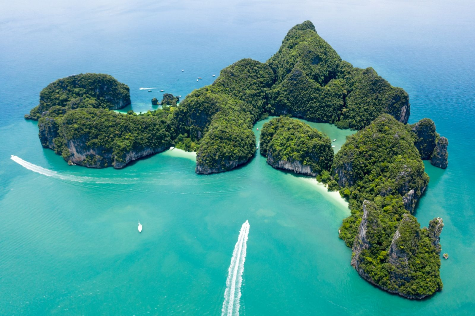
Phuket's Patong and Karon beaches carry the highest concentration of high-rise resorts and nightlife venues of anywhere in Thailand, genuinely useful if that's the trip you want, genuinely overwhelming if it isn't. Koh Yao Noi sits in Phang Nga Bay, reachable by a 30-45 minute boat from either Phuket or Krabi, and the island has no large chain resorts, most accommodation runs as small boutique guesthouses and eco-lodges built around fishing villages that still function as working communities, not tourist sets.
Highlights
- Sunrise views over Phang Nga Bay's limestone karsts
- Working fishing villages, not tourist reconstructions
- Cycling is genuinely practical given the island's flat, quiet roads
Cost
Guesthouses and small resorts run considerably below Phuket's beachfront rates, since land and construction costs stay lower without large-scale resort development. Check current listings for your specific dates instead of relying on a fixed percentage.
How to reach
Fly into Phuket International Airport, then take a taxi to Bang Rong Pier (about 45 minutes) followed by a 30-45 minute longtail or speedboat to the island. Krabi's Ao Nang pier offers a similar boat connection.
Why Koh Yao Noi is better
Phuket's Patong and Karon strips are built for volume, high-rise hotels, packed beach chairs, a nightlife district running most of the night. Koh Yao Noi keeps the same Andaman scenery without any of that infrastructure, a genuine trade of convenience for quiet that Phuket, at its current scale, can't offer anymore.
Best time to go
November through April, the dry season on Thailand's Andaman coast. May through October brings the southwest monsoon, with rougher seas that can disrupt the boat connection from Phuket or Krabi.
Nan Province (instead of Chiang Mai's Old City):
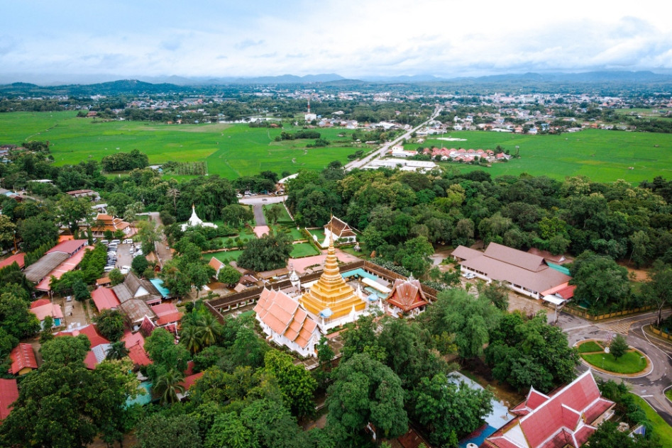
Chiang Mai's Old City draws heavy day-trip and tour-group traffic around its main temples (Wat Phra Singh, Wat Chedi Luang), genuinely crowded during peak season despite the city's real cultural depth. Nan province, further east toward the Laos border, holds a comparable density of Lanna-era temples and mountain scenery with a fraction of the visitor traffic, Wat Phumin's distinctive mural paintings and the province's wooden shophouse architecture draw considerably fewer tour buses than Chiang Mai's equivalent sights.
Highlights
- Wat Phumin's murals depict everyday Lanna-era life, not just religious scenes
- Mountain scenery comparable to Chiang Mai's Doi Suthep without the crowds
- Traditional wooden shophouse architecture still in daily use, not preserved as a museum piece
Cost
Guesthouses and local restaurants run below Chiang Mai Old City rates, reflecting the province's lower tourism development overall.
How to reach
Fly into Nan Nakhon Airport directly from Bangkok (roughly 1 hour), or drive from Chiang Mai (about 6 hours) if combining both destinations in a single trip.
Why Nan is better
Chiang Mai's Old City temples now sit on nearly every organized tour group's itinerary, and Wat Phra Singh's courtyard fills with matching umbrella groups by mid-morning most days. Nan holds a comparable density of Lanna-era temple art with a fraction of that organized-tour traffic, a genuine same-category upgrade, not a different kind of trip entirely.
Best time to go
November through February, Thailand's cool season, gives the clearest mountain views and the most comfortable temperature for exploring on foot. March through May runs considerably hotter and hazier due to regional agricultural burning.
Koh Chang (instead of Pattaya):
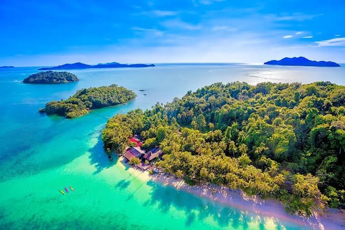
Pattaya built its reputation on nightlife and a busy, commercialized central strip, a legitimate draw for that specific trip, not for travelers wanting nature and quiet beaches in the same visit. Koh Chang, Thailand's 2nd-largest island, has formed part of Mu Ko Chang National Park since 1982, covering dense rainforest interior, multiple waterfalls including Klong Plu, and a string of beaches along its western coast considerably less developed than Pattaya's shoreline.
Highlights
- Klong Plu waterfall and several other named falls inside the national park
- White Sand Beach and Lonely Beach, both considerably quieter than Pattaya's shoreline
- Jungle trekking routes through the island's mountainous, forested interior
Cost
Bungalows and guesthouses run below Pattaya's beachfront hotel rates, though the island's more developed western beaches (Klong Prao, White Sand Beach) cost more than its quieter southern coves.
How to reach
From Bangkok, drive or bus to Trat (roughly 5-6 hours), then take a car ferry to the island (about 45 minutes). Bangkok Airways also flies directly to Trat Airport, followed by the same ferry connection.
Why Koh Chang is better
Pattaya's central strip runs on nightlife and volume, genuinely useful for that specific trip, genuinely absent of the jungle and waterfall scenery a nature-focused traveler actually wants. Koh Chang's national park interior gives real trekking and waterfall access that Pattaya's built-up coastline simply doesn't have room for.
Best time to go
November through April, the dry season. Many smaller bungalow operations and restaurants close entirely from roughly May through October when heavy rain reduces both road access and beach conditions.
Koh Tao (instead of Koh Samui):
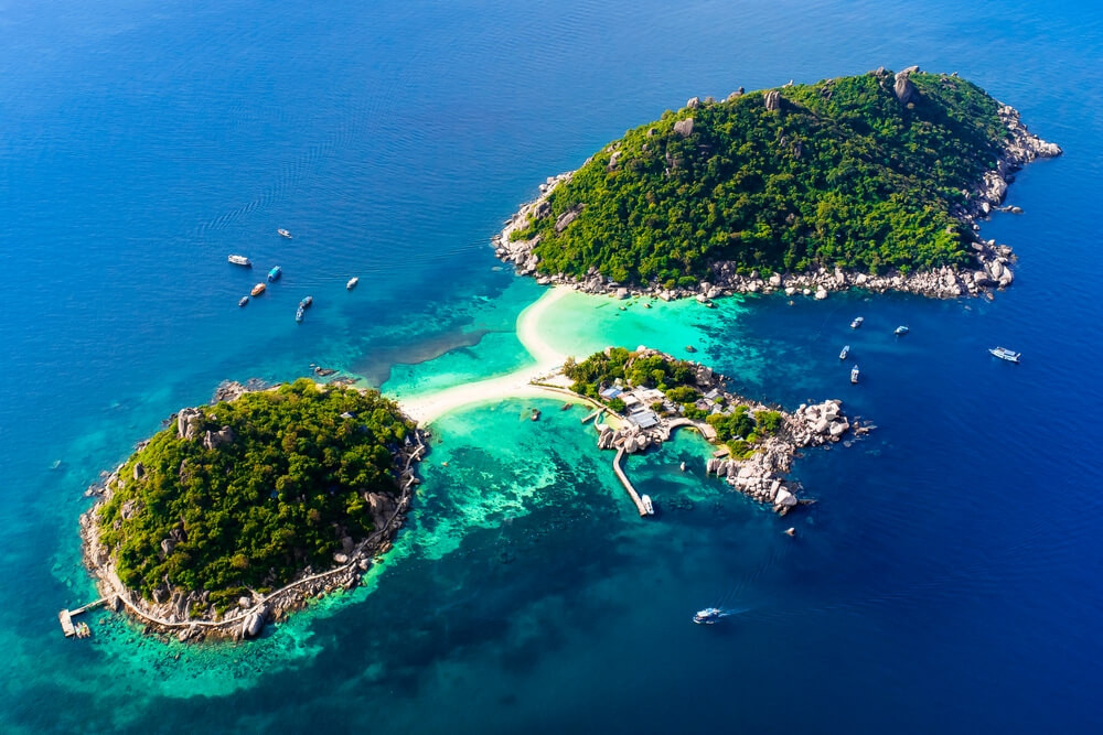
Koh Samui holds Thailand's most developed non-Phuket resort infrastructure, luxury hotels, an international airport, established nightlife, genuinely convenient but genuinely built up. Koh Tao, considerably smaller at roughly 21 square kilometers, functions as one of the world's most active PADI dive certification hubs by course volume, dozens of dive shops operate on an island small enough to walk across in under an hour.
Highlights
- Among the highest concentration of dive shops per square kilometer in Southeast Asia
- Coral reefs reachable directly from several beaches without a boat
- Sairee Beach and quieter coves like Freedom Beach both accessible on foot or by short taxi
Cost
Accommodation and diving courses run below Koh Samui's resort pricing; a PADI Open Water certification here typically costs less than the same course booked through a Samui-based operator.
How to reach
Ferry from Koh Samui (about 1.5-2 hours) or Chumphon on the mainland (about 1.5 hours), both connecting to buses or flights from Bangkok. No airport exists on Koh Tao itself.
Why Koh Tao is better
Koh Samui's resort infrastructure and airport make it genuinely convenient, but that same development has pushed reef quality and diving focus toward the smaller islands nearby. Koh Tao built its entire identity around diving specifically, dozens of shops competing on quality and price in a way Koh Samui's broader luxury-resort market never needed to.
Best time to go
March through September gives the calmest water and best underwater visibility for diving. November can bring monsoon runoff from Gulf of Thailand storms, worth checking conditions before booking a dive-focused trip specifically around that month.
Koh Lipe (instead of Phi Phi Islands):
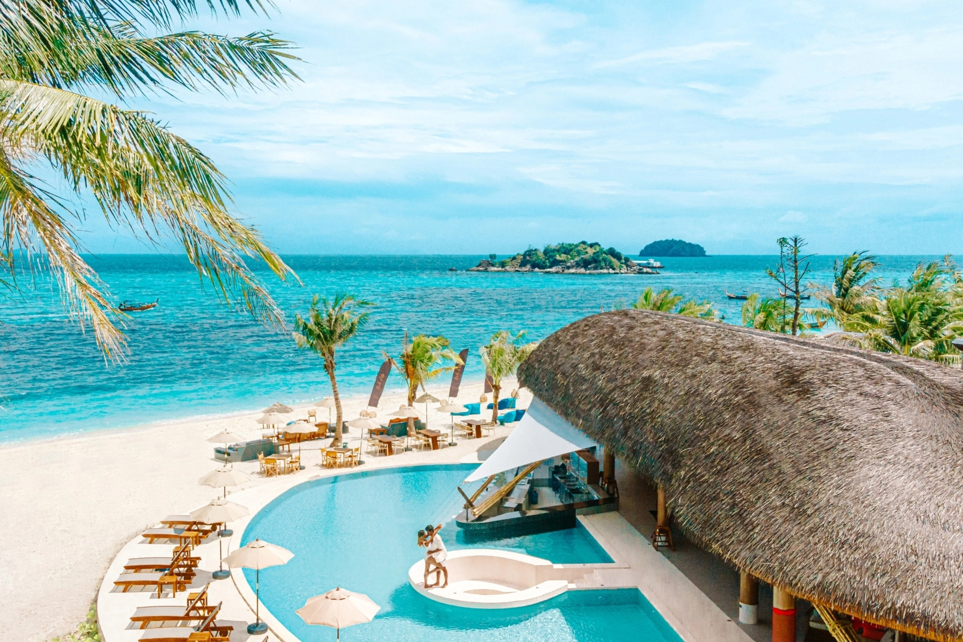
Phi Phi Islands carry heavy day-tour boat traffic from Phuket and Krabi, genuinely scenic but genuinely crowded at the main viewpoints and beaches during midday tour windows. Koh Lipe, part of Tarutao Marine National Park near the Malaysian border, earned the nickname "Maldives of Thailand" for its soft white sand and clear turquoise water, and the island is small enough to walk end to end in under 30 minutes, with considerably less day-tour boat traffic given its more remote location.
Highlights
- Sunrise Beach and Sunset Beach both named for their respective view directions
- Coral reefs close enough to shore for snorkeling without a boat trip
- Small enough scale that the whole island stays walkable
Cost
Guesthouses and small resorts run below Phi Phi's peak-season rates, since Koh Lipe's more remote location has limited large-scale resort development compared to Phi Phi Don's built-up center.
How to reach
Fly into Hat Yai or Trang, then take a minivan to Pak Bara pier (roughly 1.5-2 hours) followed by a 1.5-2 hour ferry, seasonal (roughly November-April) since rough seas limit ferry service outside that window.
Why Koh Lipe is better
Phi Phi's main viewpoints and beaches see a steady flow of day-tour boats from both Phuket and Krabi through the midday hours, genuinely crowded at the exact times most photos get taken. Koh Lipe's more remote location near the Malaysian border keeps day-tour volume considerably lower, and the island's small, walkable scale means the crowding Phi Phi has never really applies here.
Best time to go
November through April. Ferry service to the island stops almost entirely from May through October due to rough Andaman Sea conditions, so this isn't just a preference, it's close to a hard requirement for reaching the island by boat.
Koh Mook (instead of Ao Nang):
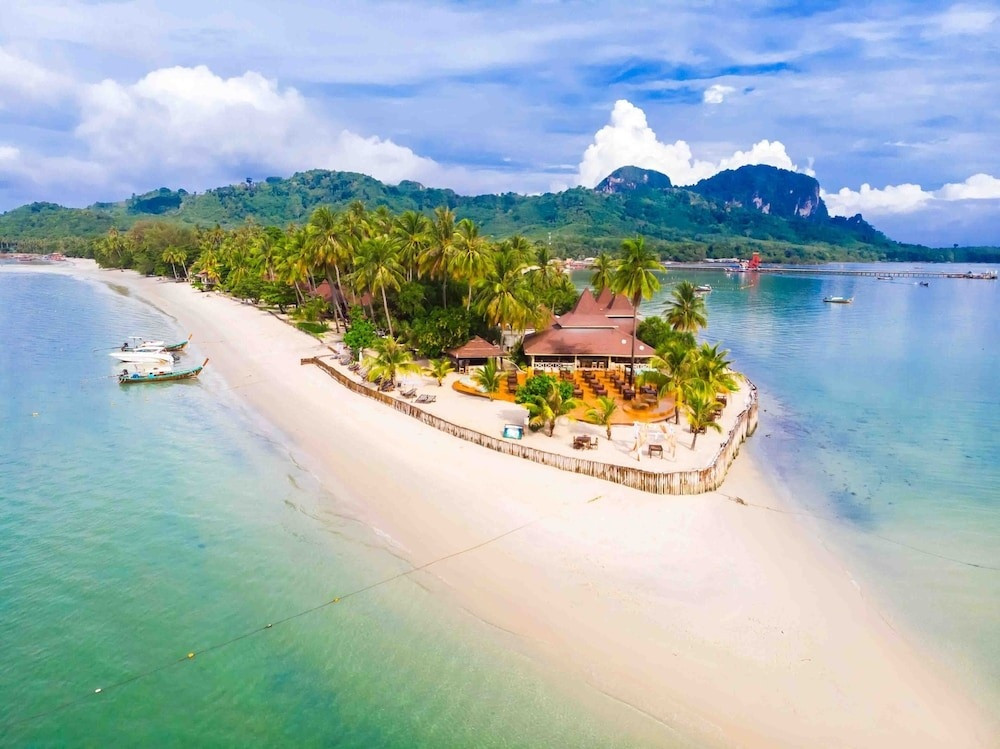
Ao Nang runs busy with longtail boat traffic and day-trip crowds heading to nearby islands, convenient as a base but rarely a destination in its own right. Koh Mook holds Tham Morakot (Emerald Cave), a sea cave reachable only by swimming or kayaking through an 80-meter dark tunnel at low tide, opening into a hidden beach enclosed by cliffs, no boat can enter directly, which keeps visitor numbers genuinely lower than boat-accessible attractions nearby.
Highlights
- Emerald Cave's hidden beach, reachable only at specific tide windows
- A traditional fishing village atmosphere along the island's main settlement
- Considerably less boat traffic than Ao Nang's main departure points
Cost
Guesthouses run below Ao Nang's beachfront rates; most visitors reach the Emerald Cave via a guided tour, typically priced per boat, not per person.
How to reach
Fly into Trang Airport, then drive to Pak Meng pier (about 40 minutes) followed by a 30-45 minute longtail boat to the island. Ferries run seasonally, most reliably November through April.
Why Koh Mook is better
Ao Nang functions mainly as a launch point for other islands, busy with longtail boat traffic heading out each morning and rarely a destination worth staying at itself. Koh Mook holds an actual attraction unavailable anywhere near Ao Nang, a cave only reachable by swimming, which naturally limits visitor volume in a way no amount of marketing could replicate at a boat-accessible site.
Best time to go
November through April for reliable ferry access. The Emerald Cave itself is tide-dependent regardless of season, check local tide tables for the low-tide window that makes the swim-through passage accessible.
Sukhothai (instead of Ayutthaya):
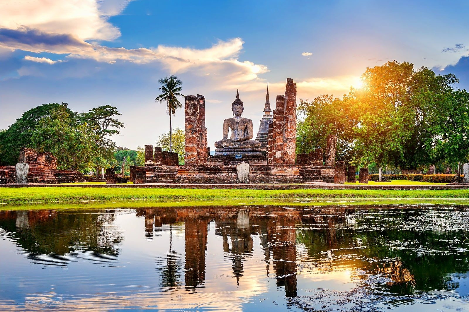
Ayutthaya sits only about 80 km from Bangkok, which makes it a convenient day trip and, as a direct result, one of the most crowded historical sites in the country during peak tourist season. Sukhothai, founded in 1238 as the first capital of Siam and UNESCO-listed since 1991, sits roughly 400-440 km from Bangkok, a real distance that limits casual day-trip traffic and keeps the park's roughly 193 documented monuments across 70 square kilometers genuinely quieter to explore.
Highlights
- Wat Mahathat, the park's centerpiece temple complex
- Wat Si Chum's giant seated Buddha, framed dramatically through a narrow gap in the enclosing wall
- King Ramkhamhaeng, Sukhothai's 3rd ruler, is credited with developing the Thai alphabet here
Cost
Each zone (Central, North, West) charges roughly 100 THB for foreign visitors; a combined ticket covering multiple zones runs 300-400 THB. Bicycle rental costs 30-50 THB per day, the practical way to cover the park's flat, spread-out layout.
How to reach
From Bangkok, a direct VIP bus from Mo Chit terminal takes 7-10 hours (365-500 THB), or fly Bangkok Airways to Sukhothai Airport (about 1 hour 20 minutes) followed by a short taxi transfer.
Why Sukhothai is better
Ayutthaya's 80 km distance from Bangkok makes it an easy half-day tour-bus stop, and that same convenience is exactly what fills its temple grounds with day-trip crowds most mornings. Sukhothai's greater distance filters out casual day-trippers by default, leaving a quieter, more spread-out park that rewards an actual overnight stay, not a rushed few hours between bus transfers.
Best time to go
November through February, the cool season, for comfortable cycling temperatures around the park. March through May runs hot enough that midday cycling becomes genuinely uncomfortable.
A Realistic Route Combining Several of These:
This route moves roughly north to south, culture first, then islands, ending near the Malaysian border. It's honest about the backtracking this actually requires: Koh Chang sits in the far east near Cambodia, Koh Tao sits in the Gulf of Thailand, and the Andaman islands (Koh Yao Noi, Koh Mook, Koh Lipe) sit on the opposite coast entirely. A genuinely seamless overland route between all 7 doesn't exist, several legs route back through Bangkok or a regional hub, and the day-by-day breakdown below accounts for that honestly. It doesn't pretend the transit is instant.
27 days covers all 7 stops with enough time at each to justify the travel, not a rushed 1-night stop. A shorter 10-14 day version, picking 3-4 destinations, not all 7, follows after the full breakdown.
Week 1: Bangkok, Sukhothai, and the transit east
Arrive in Bangkok, adjust to the time zone, and use the 2 days for a light orientation, Grand Palace, Wat Arun, and a first taste of the city's street food scene before heading north.
VIP bus from Mo Chit terminal to Sukhothai (7-10 hours), or fly Bangkok Airways directly (about 1 hour 20 minutes) to save the travel day.
Sukhothai Historical Park across 3 days: Central Zone and Wat Mahathat on day 1, North and West Zones including Wat Si Chum on day 2, an optional day trip to Si Satchanalai Historical Park (about 1 hour away) on day 3.
Bus or flight back to Bangkok, connecting onward toward Trat and Koh Chang the same day or the next morning depending on connection times.
Week 2: Koh Chang and the crossing to the Gulf
Bus or flight from Bangkok to Trat (5-6 hours by road, shorter by air), then the car ferry to Koh Chang (about 45 minutes).
Koh Chang across 4 days: settle in and walk White Sand Beach or Lonely Beach on arrival, hike to Klong Plu waterfall, a full day snorkeling or island-hopping to Koh Wai or Koh Rang, and a final relaxed day before departing.
Ferry back to Trat, then bus or flight to Bangkok, followed by a connection toward Chumphon or directly to Koh Samui for the Koh Tao ferry. This crossing genuinely takes the better part of 2 days given the distance between the Gulf's east and south coasts.
Week 3: Koh Tao and the move to the Andaman coast
Koh Tao across 4 days: arrive and settle near Sairee Beach, then 3 days for a PADI Open Water certification course if diving for the first time (or fewer days of fun dives if already certified), closing with a hike to a viewpoint like John-Suwan.
Ferry to the mainland (Chumphon or Koh Samui), then a flight to Phuket, the gateway for the Andaman island cluster ahead.
Week 4: The Andaman islands, Koh Yao Noi to Koh Lipe
Koh Yao Noi across 3 days: arrival and village walk on day 1, cycling and kayaking through Phang Nga Bay on day 2, a boat trip to nearby Koh Yao Yai or a smaller snorkeling island on day 3.
Boat back to Phuket or Krabi, then onward transport toward Trang for the Koh Mook crossing.
Koh Mook across 2 days: arrival and village exploration on day 1, the guided Tham Morakot (Emerald Cave) swim-through tour timed around the low-tide window on day 2.
Longtail to Pak Meng, then transport to Hat Yai or Trang, followed by a minivan to Pak Bara pier for the Koh Lipe ferry.
Koh Lipe as the trip's closing stop: Sunrise Beach snorkeling, a walk of the island's short main strip, and a boat trip within Tarutao Marine National Park before flying home from Hat Yai.
Shorter option: a realistic 10-14 day trip works better picking 3-4 of these, not all 7. Sukhothai plus Koh Chang in the east keeps transit reasonable, and Koh Yao Noi, Koh Mook, and Koh Lipe together in the south (skipping the Gulf coast entirely) avoids the longest cross-country transit days in the full route above.






{{item.get_author.first_name}} {{item.get_author.last_name}}
Level 7
5 Photos
36 Reviews
{{item.comment_txt}}
{{item_reply.get_author.first_name}} {{item_reply.get_author.last_name}}
@ {{item_reply.reply_to}}, {{item_reply.reply_txt}}