

Angel Falls in Venezuela is the tallest waterfall in the world at 979 meters total (807 meters of uninterrupted free fall). Victoria Falls is the widest single sheet at 1,708 meters. Kaieteur Falls in Guyana holds the record for largest waterfall by single-drop volume and height combined, at 226 meters in 1 unbroken plunge. Jim Jim Falls in Australia is closed for the entire 2026 dry season for infrastructure upgrades, worth checking before planning a trip around it.
Most "most beautiful waterfalls" lists repeat the same formulaic closing on every single entry, something like "X proudly holds its place among the world's most famous and greatest waterfalls." That sentence tells you nothing. It doesn't say how tall the waterfall actually is, whether you can drive there, or what it costs to get in.
This guide covers 30 waterfalls organized by continent, each with a real measurement, an entrance cost, a short highlights list, and specific directions on how to actually reach it, including flagging that Jim Jim Falls in Australia's Kakadu National Park is closed for the entire 2026 dry season, a detail that would ruin a trip planned around it without knowing in advance.
10 waterfallsNorth America:
From Niagara's 3-falls system to a waterfall inside a Tennessee cave, North America's entries range from the most-visited waterfall on Earth to genuinely obscure ones.
Niagara Falls:
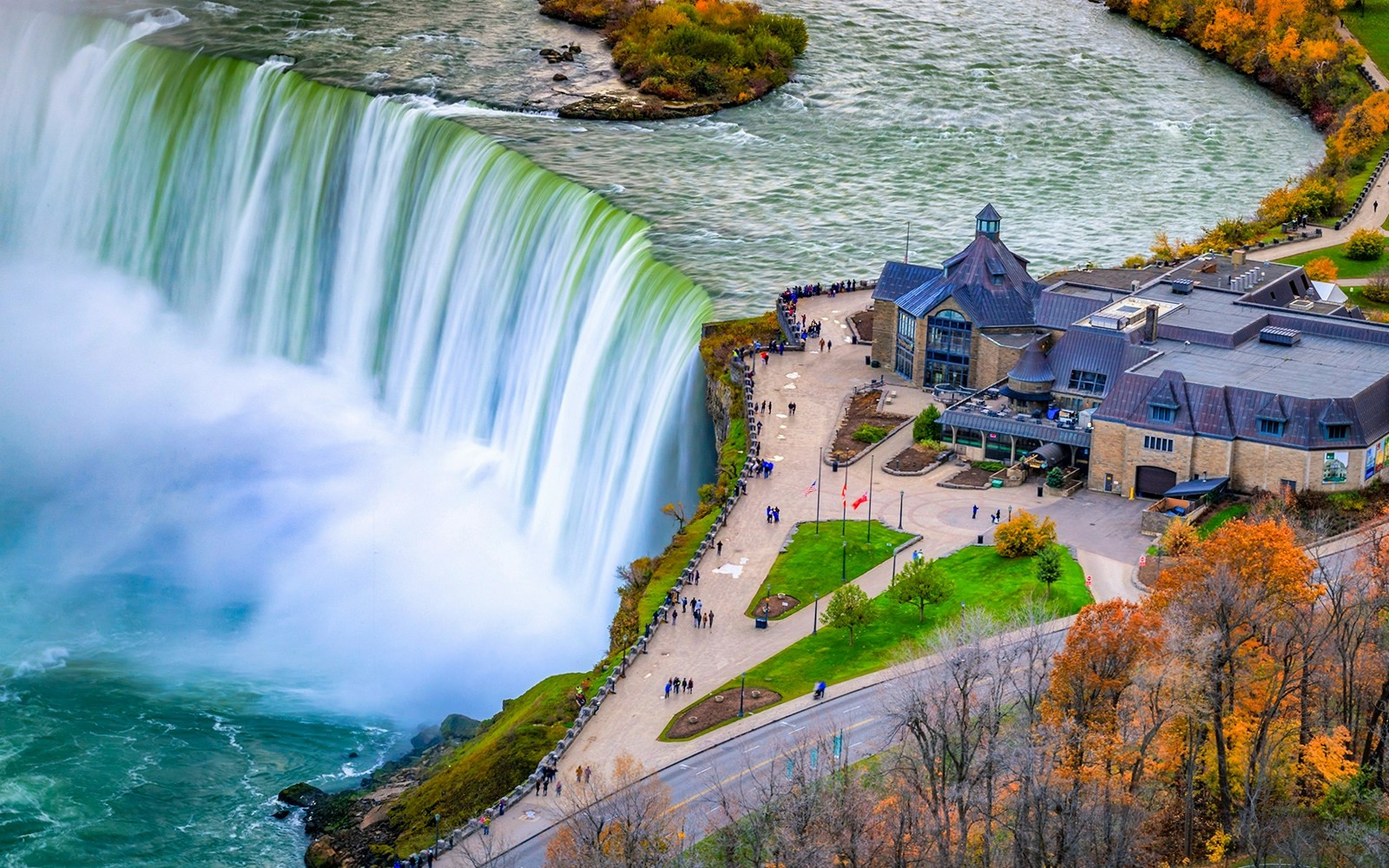
Niagara actually consists of 3 separate waterfalls: Horseshoe Falls (the largest, mostly on the Canadian side), American Falls, and the smaller Bridal Veil Falls, all fed by the Niagara River between Lake Erie and Lake Ontario. Horseshoe Falls drops between 51 and 57 meters depending on measurement point, and roughly 168,000 cubic meters of water flow over the crest every minute during peak daytime flow (reduced at night and off-season under a water-diversion agreement with hydroelectric plants). The Canadian side offers the better overall view since Horseshoe Falls faces outward from the US side; the Maid of the Mist and Hornblower boat tours run from both sides into the mist at the base.
Best time: June through August for the fullest flow and warmest boat tour conditions; February for the frozen ice formations at the base.
Highlights
- 3 separate falls in 1 system: Horseshoe, American, and Bridal Veil
- Canadian side gives the better overall view since Horseshoe Falls faces outward
- Boat tours run from both sides directly into the base mist
Cost
Free to view from either side. Ontario parking runs CAD $10-33/day depending on lot; boat tours (Maid of the Mist/Hornblower) cost roughly USD/CAD $25-30 per adult.
How to reach
Fly into Toronto Pearson (YYZ) or Buffalo Niagara (BUF), then drive roughly 1.5-2 hours. The Canadian side is walkable along Niagara Parkway; the US side centers on Niagara Falls State Park, reachable on foot from downtown Niagara Falls, NY.
Yosemite Falls:
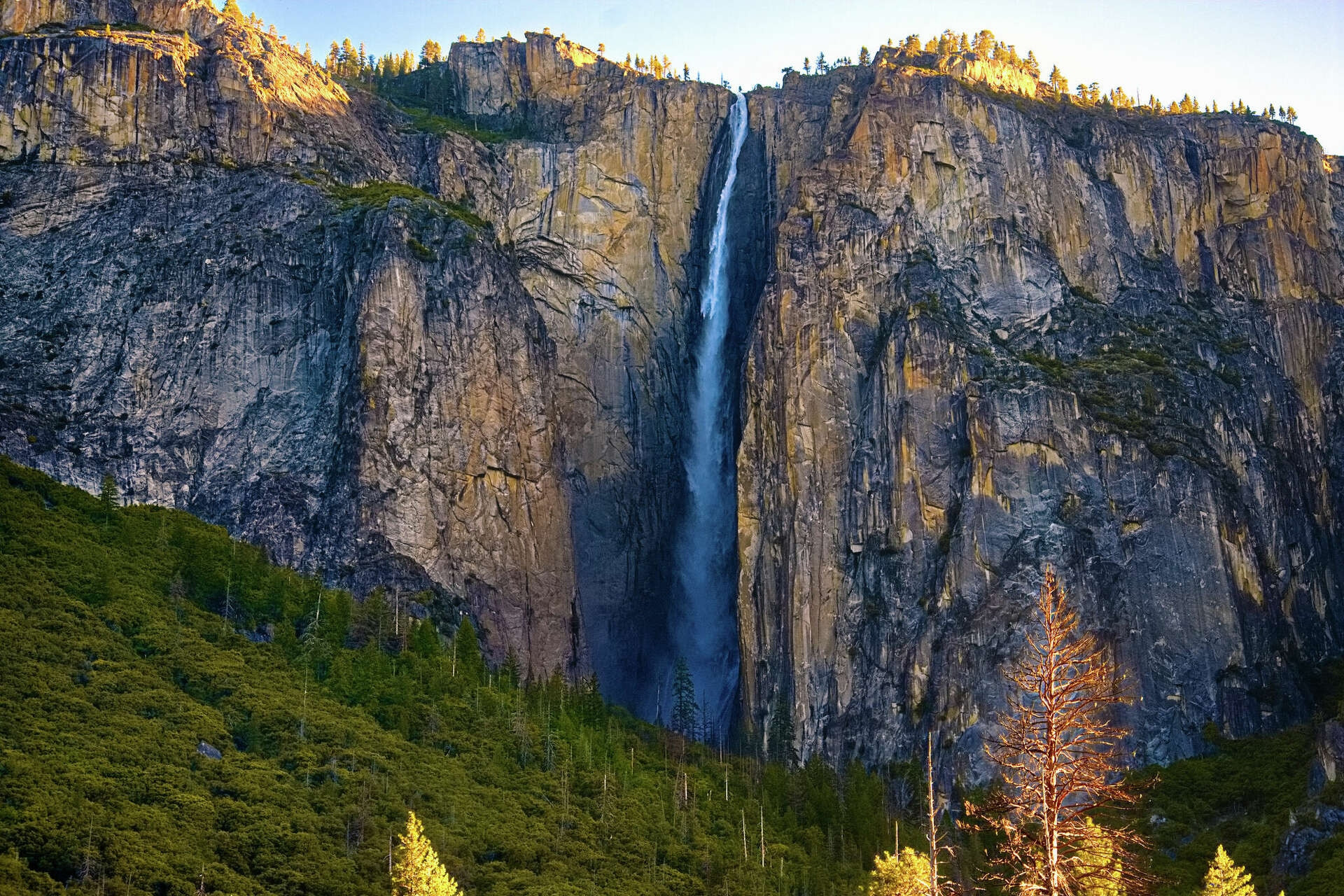
At 739 meters total, Yosemite Falls ranks as the tallest waterfall in North America, split into 3 sections: Upper Yosemite Fall (435m), the middle cascades (205m), and Lower Yosemite Fall (98m). The paved, 1.6-kilometer roundtrip trail to the base of Lower Yosemite Fall stays open and accessible most of the year, while the fall itself often slows to a trickle or stops entirely by late summer, since it depends entirely on snowmelt, not a year-round spring source.
Best time: Late April through June, during peak snowmelt; the fall frequently runs dry from August through October.
Highlights
- 739m total across 3 sections, tallest waterfall in North America
- Often runs completely dry by late summer, since it depends on snowmelt
- The paved 1.6km trail to the base stays open most of the year
Cost
Yosemite National Park entrance runs USD $35 per vehicle (valid 7 days) or free with an $80 annual America the Beautiful pass. No separate fee for the waterfall itself.
How to reach
Fly into Fresno Yosemite International (FAT) and drive roughly 1.5-2 hours, or fly into San Francisco and drive about 3.5-4 hours. The trailhead sits in Yosemite Valley, reachable by the free park shuttle from most Valley lodging.
Havasu Falls:
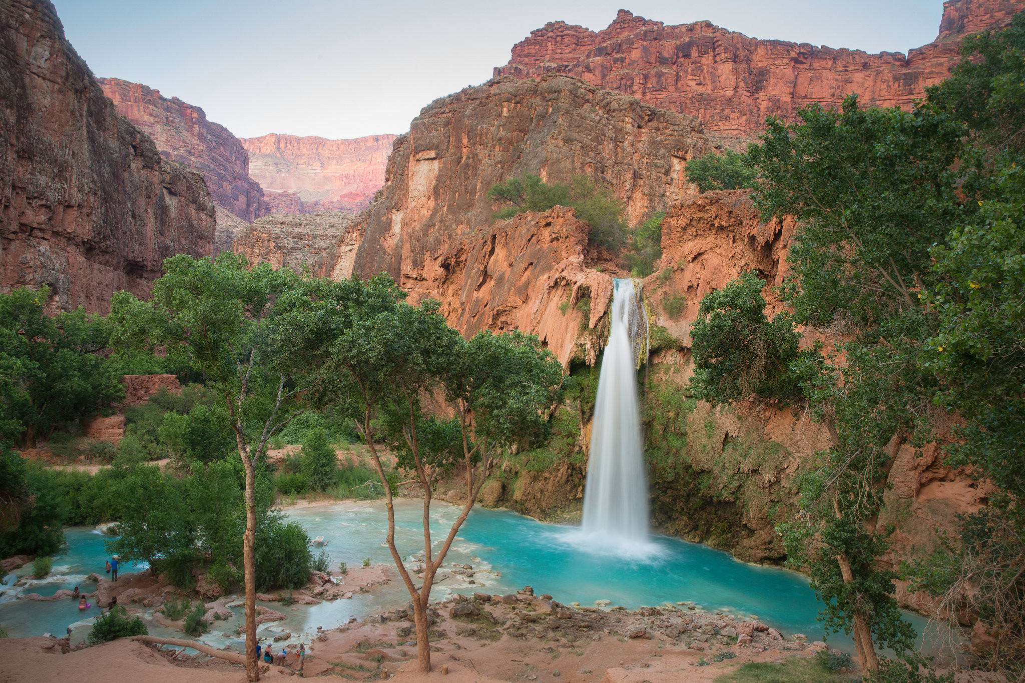
Havasu Falls drops 30 meters into a turquoise pool colored by dissolved calcium carbonate in the water, on tribal land inside the Havasupai Reservation, not the main Grand Canyon National Park boundary. Reaching it requires a 16-kilometer roundtrip hike each way from Hualapai Hilltop and a permit booked directly through the Havasupai tribe, not a federal park pass, and permits for the following season regularly sell out within hours of release each February.
Best time: March through May or September through October, avoiding summer flash-flood risk and the coldest winter months.
Highlights
- 30m drop into a turquoise pool colored by dissolved calcium carbonate
- Located on Havasupai tribal land, not inside Grand Canyon National Park's main boundary
- Permits for the following season regularly sell out within hours of February release
Cost
A Havasupai tribal permit is required, bundled with mandatory camping or lodge stays; multi-night packages typically run USD $395-455 per person, booked directly through the tribe, not a federal park pass.
How to reach
Drive to Hualapai Hilltop (roughly 3.5 hours from Flagstaff or Las Vegas), then hike 16km roundtrip each way; helicopter transport is available on specific days for an additional fee, weather permitting.
Multnomah Falls:
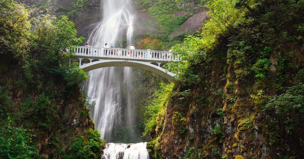
Multnomah Falls drops 189 meters in 2 tiers, and the Benson Bridge, built in 1914, crosses directly between the upper and lower drops, giving visitors a close view most 2-tier waterfalls don't offer from a fixed structure. It sits directly off Interstate 84, making it one of the most accessible major waterfalls in the US, no hike required to see the full drop from the base, though the paved trail up to Benson Bridge and beyond adds real elevation gain for anyone continuing further.
Best time: Spring for peak snowmelt flow and wildflowers along the trail; a timed-entry reservation is required during summer weekends.
Highlights
- 189m drop across 2 tiers
- The Benson Bridge, built in 1914, crosses directly between the upper and lower drops
- Directly visible from Interstate 84, no hike required for the base view
Cost
Free to view. A timed-entry parking permit (roughly USD $2 reservation fee) is required during peak summer weekends.
How to reach
A roughly 30-minute drive east of Portland on Interstate 84 (Exit 31), with a dedicated parking area and pedestrian bridge from the historic Columbia River Highway.
Shoshone Falls:
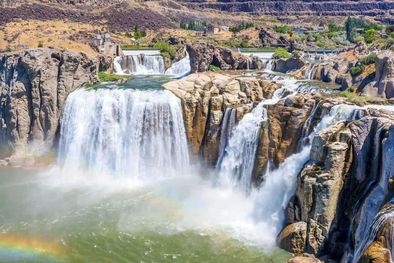
Shoshone Falls drops 65 meters, several meters taller than Niagara's Horseshoe Falls, over a curved rim spanning close to 300 meters, earning it the nickname "Niagara of the West." Flow varies enormously by season and by upstream irrigation demand; the falls run at genuinely spectacular volume during spring snowmelt and can slow to a comparative trickle by late summer once irrigation diversions upstream draw down the Snake River.
Best time: March through June, before summer irrigation diversions reduce the river's flow significantly.
Highlights
- 65m drop, taller than Niagara's Horseshoe Falls
- Nicknamed the 'Niagara of the West'
- Flow varies enormously by season due to upstream irrigation diversions
Cost
Twin Falls city park entry runs roughly USD $3-5 per vehicle during peak season (May-September); free the rest of the year.
How to reach
A roughly 5-minute drive from downtown Twin Falls, Idaho, off Falls Avenue East; the nearest airport is Magic Valley Regional (TWF), about 10 minutes away.
Ruby Falls:
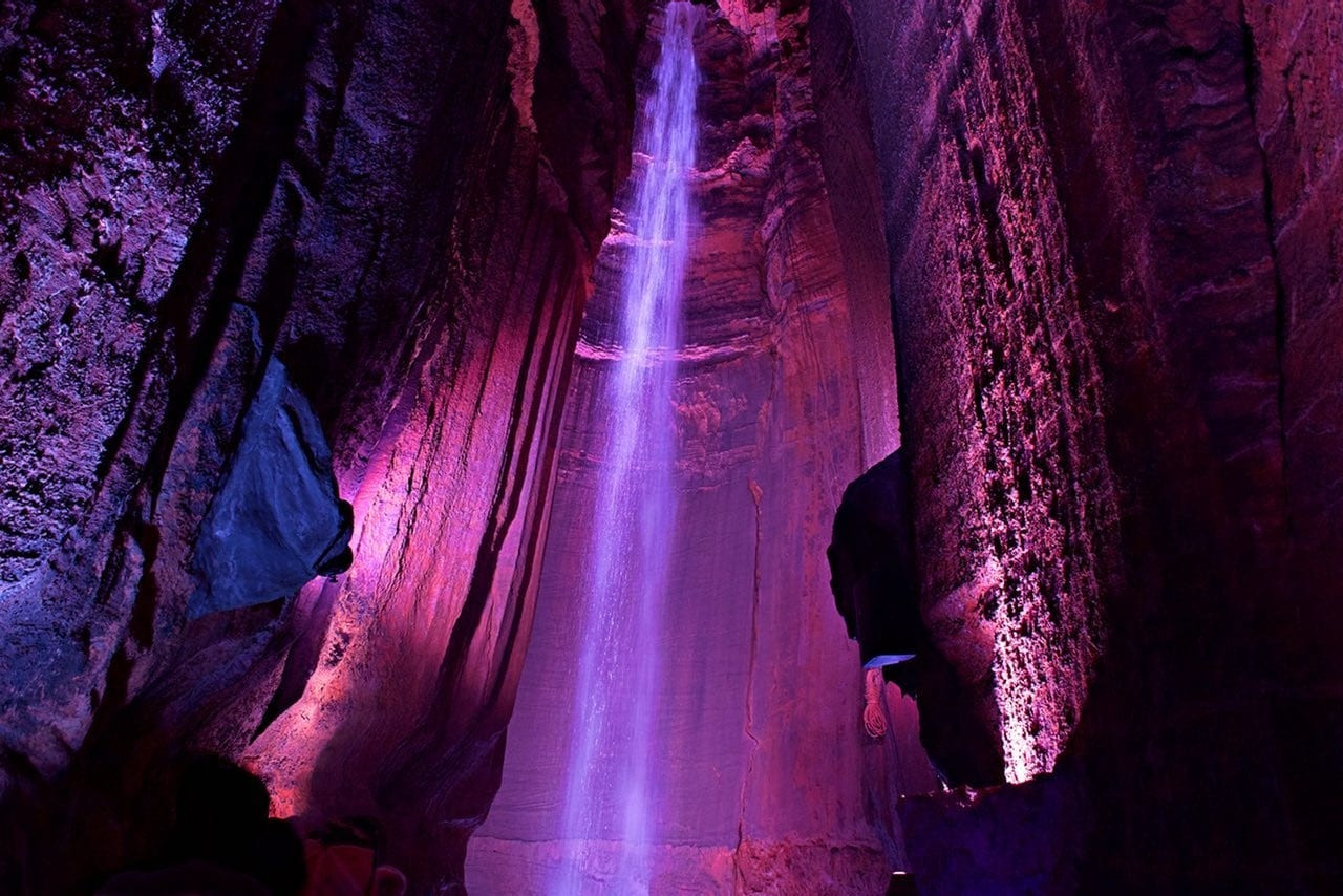
Ruby Falls drops 44 meters inside a cave roughly 335 meters underground, discovered in 1928 by Leo Lambert while exploring a different cave system on Lookout Mountain, and it remains the tallest and deepest underground waterfall open to the public in the US. The full experience runs as a guided tour through the cave passage leading to the waterfall chamber, genuinely different from every other entry on this list since there's no daylight or open-air approach at any point.
Best time: Booking tickets in advance for a morning or weekday slot avoids the longest tour queues, since capacity per tour group is limited.
Highlights
- 44m underground drop, the tallest and deepest public underground waterfall in the US
- Discovered in 1928 by Leo Lambert while exploring a different cave system
- The full visit is a guided tour with no daylight at any point
Cost
Standard adult admission runs roughly USD $25-35, higher for combo tickets including the Lookout Mountain Incline Railway or Rock City.
How to reach
A roughly 10-minute drive from downtown Chattanooga, Tennessee, up Lookout Mountain; the nearest airport is Chattanooga Metropolitan (CHA), about 20 minutes away.
Palouse Falls:
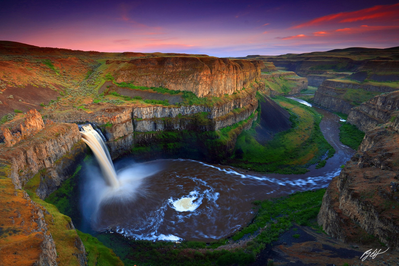
Palouse Falls drops 61 meters into a canyon carved by the Missoula Floods, a series of catastrophic glacial lake outburst floods that repeatedly scoured the region roughly 13,000 to 15,000 years ago, leaving behind the dramatic basalt canyon walls visible today. Washington designated it the official state waterfall in 2014, and flow peaks dramatically between April and early June before dropping off considerably through the drier summer months.
Best time: April through early June for peak flow; the canyon rim viewpoints stay accessible year-round regardless of water volume.
Highlights
- 61m drop into a canyon carved by the Missoula Floods roughly 13,000-15,000 years ago
- Washington's official state waterfall since 2014
- Canyon rim viewpoints stay accessible year-round regardless of water volume
Cost
Washington State Parks charges a Discover Pass (roughly USD $10/day or $30/year) for vehicle access.
How to reach
A roughly 1.5-hour drive from Spokane or 2.5 hours from Seattle via rural highways; the park has a small paved lot directly at the main viewpoint.
Akaka Falls:
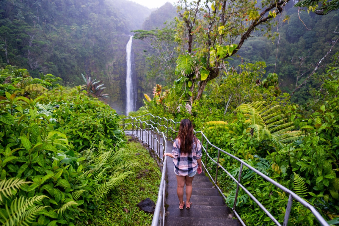
Akaka Falls drops 135 meters in a single sheer plunge inside a rainforest gorge on the Big Island, reachable via a 0.7-kilometer loop trail that also passes the smaller Kahuna Falls along the way. The trail stays paved and family-friendly for its full length, a genuine rarity for a waterfall this tall, most comparably sized falls require considerably more strenuous access.
Best time: Year-round, though the wettest months (November through March) bring the fullest flow at the cost of a muddier trail.
Highlights
- 135m single sheer plunge inside a rainforest gorge
- The 0.7km paved loop trail also passes smaller Kahuna Falls
- A rare fully paved, family-friendly trail for a waterfall this tall
Cost
Akaka Falls State Park charges roughly USD $5 per vehicle for non-Hawaii residents, or USD $1 for pedestrians.
How to reach
Fly into Hilo International Airport (ITO) and drive roughly 30-40 minutes north on Highway 19, then a short distance inland on Akaka Falls Road.
Bridalveil Fall:
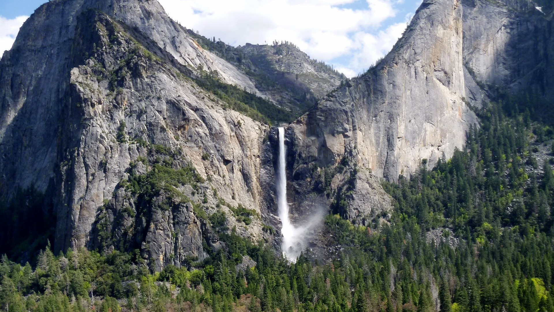
Bridalveil Fall drops 189 meters and runs year-round, unlike Yosemite Falls nearby, which frequently dries up by late summer, since Bridalveil draws from a more consistent water source. The paved, 0.8-kilometer roundtrip trail to the base takes about 20 minutes, and strong winds regularly blow the falling water sideways in a visible sway, the origin of its name.
Best time: Spring for the fullest flow, though unlike Yosemite Falls, Bridalveil keeps flowing through summer and fall.
Highlights
- Flows year-round, unlike many Yosemite waterfalls
- Wind regularly sways the falling water sideways
- A short, paved, accessible trail to the base
Cost
Free; covered by the Yosemite National Park entrance fee (USD $35/vehicle).
How to reach
Located along Southside Drive in Yosemite Valley, reachable by the free park shuttle or a short drive from Yosemite Village.
Fall Creek Falls:
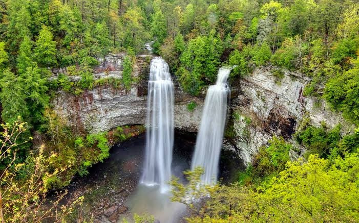
Fall Creek Falls drops 78 meters, ranking among the highest free-fall waterfalls east of the Mississippi River. A moderate 4.3-kilometer trail leads to the base, and the surrounding state park holds several other named waterfalls (Cane Creek Falls, Piney Falls) within a short drive, giving visitors a genuine multi-waterfall day, not just a single stop.
Best time: Winter for the fullest flow and fewer crowds; the trail stays open year-round.
Highlights
- Among the tallest free-fall waterfalls east of the Mississippi
- Several other named waterfalls sit within the same state park
- Winter brings the strongest flow, opposite of most US waterfalls' summer peak
Cost
Free; Tennessee state parks charge no general entrance fee.
How to reach
A roughly 1.5-hour drive from Chattanooga or Nashville; the park has its own visitor center and marked trailhead parking.
5 waterfallsSouth America:
South America holds both the world's tallest waterfall and its largest single-drop waterfall, within a continent apart from each other.
Angel Falls:
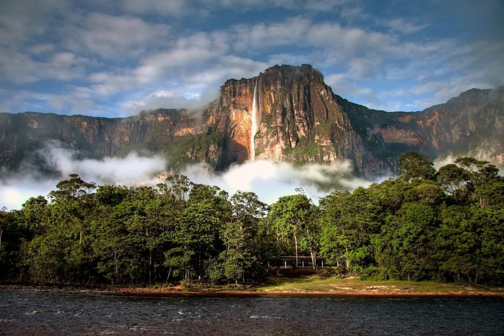
At 979 meters total with an 807-meter uninterrupted free fall, Angel Falls ranks as the world's tallest waterfall, named after American aviator Jimmie Angel, who crash-landed his plane on the adjacent plateau in 1933 while searching for gold. The indigenous Pemon name, Kerepakupai Merú, predates that by centuries. No road reaches the falls; visitors fly to the town of Canaima, then take a river boat, timed around the rainy season (June through December) when water levels allow boats through the shallower stretches.
Best time: June through December, rainy season, when river levels allow boat access; the dry season often leaves the boat route impassable.
Highlights
- 979m total height, 807m free fall, the tallest waterfall in the world
- Named after aviator Jimmie Angel, who crash-landed nearby in 1933
- No road access exists; the journey is part of the experience
Cost
No direct entrance fee, but reaching the falls requires a multi-day tour package (typically USD $400-700 per person) covering the flight to Canaima, boat transport, and camping.
How to reach
Fly into Puerto Ordaz or Ciudad Bolívar, then take a small charter flight to Canaima. From Canaima, a river boat (available only June-December when water levels allow) covers the final approach, typically as part of a 2-3 day guided package.
Iguazu Falls:
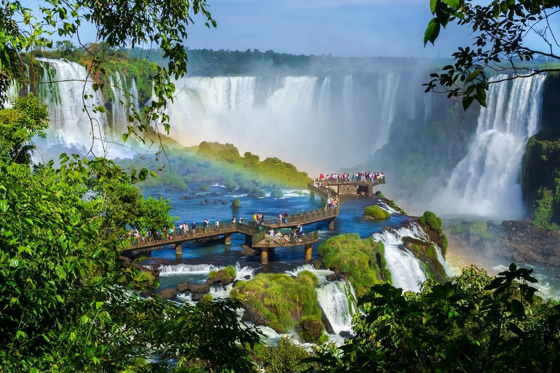
Iguazu Falls spans 2.7 kilometers and comprises roughly 275 individual drops ranging from 60 to 82 meters, with the horseshoe-shaped Devil's Throat as the tallest and most powerful single section. Both UNESCO-listed national parks, one on each side of the border, offer genuinely different vantage points: Argentina's side puts visitors closer to individual falls via extensive catwalks, while Brazil's side gives the wider panoramic view across the full system.
Best time: Visit both the Argentine and Brazilian sides if time allows, since each offers a genuinely different perspective on the same falls system.
Highlights
- 275 individual drops across a 2.7km system
- Devil's Throat is the tallest and most powerful single section
- Argentina's side gets you closer via catwalks; Brazil's side gives the wider panoramic view
Cost
Argentina side runs roughly USD $22-40 for international visitors (price fluctuates with Argentine peso inflation); Brazil side runs roughly USD $18-20. Both parks charge separately; visiting both sides means paying twice.
How to reach
Fly into Cataratas del Iguazú Airport (Argentina) or Foz do Iguaçu Airport (Brazil), both roughly 20-30 minutes from their respective park entrances. Puerto Iguazú (Argentina) and Foz do Iguaçu (Brazil) both serve as practical overnight bases.
Kaieteur Falls:
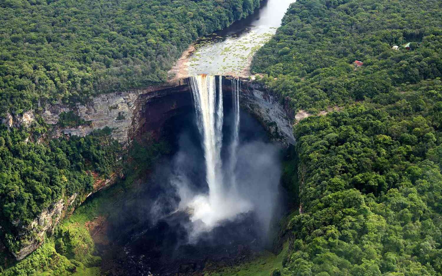
Kaieteur Falls drops 226 meters in a single, uninterrupted plunge on the Potaro River, making it the world's largest waterfall by single-drop volume combined with height, a distinction separate from simply being tall. The falls sit deep inside Guyana's rainforest with no road access at all; visitors reach it by a roughly 45-minute chartered flight from Georgetown, and the site sees a genuine fraction of the annual visitors that Iguazu or Niagara receive despite the scale of what's there.
Best time: August through November tends to bring more reliable flying weather; the falls run year-round regardless of season.
Highlights
- 226m single, uninterrupted plunge, the world's largest waterfall by single-drop volume and height combined
- No road access exists anywhere in the area
- Sees a genuine fraction of the visitors Iguazu or Niagara receive
Cost
No entrance fee to the falls themselves; a chartered flight from Georgetown (the only practical access) typically costs USD $200-300 round-trip as part of a day tour.
How to reach
Fly into Georgetown's Ogle Airport and take a roughly 45-minute chartered flight directly to Kaieteur, typically as a day tour with a few hours at the falls before returning.
Yumbilla Falls:
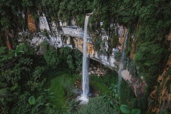
Yumbilla Falls measures 895 meters across multiple tiered drops, ranking among the tallest waterfalls in the world by total height, though it remained largely undocumented outside the local area until a 2007 government survey brought international attention to it. Reaching it requires a hike from the town of Cuispes through cloud forest terrain, considerably less developed for tourism than Peru's more famous Machu Picchu region.
Best time: May through September, the drier season in this part of the Peruvian Amazon, for more reliable trail conditions.
Highlights
- 895m total height across multiple tiered drops, among the tallest in the world
- Remained largely undocumented internationally until a 2007 survey
- Reached through cloud forest terrain far less developed for tourism than Machu Picchu
Cost
A small local entrance fee applies, typically under USD $5, collected by the community-run access point in Cuispes.
How to reach
Fly into Jaén or Tarapoto, then drive several hours to Pedro Ruiz and on to Cuispes, followed by a guided hike (horses are available for part of the route) through cloud forest terrain.
Agrio Falls:
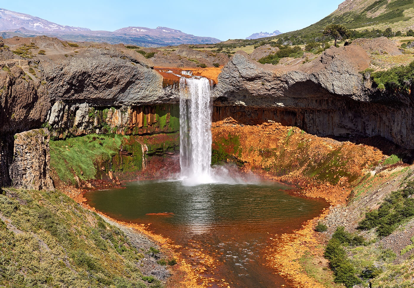
Agrio Falls (Salto del Agrio) drops 60 meters as the Agrio River descends a rocky ledge into a vivid green pool, colored partly by dissolved minerals from the surrounding volcanic terrain. Red and yellow volcanic rock frames the falls, a genuinely different color palette from most waterfalls on this list, and the site sits close enough to the small town of Caviahue for an easy half-day visit.
Best time: Early morning for the best chance of a rainbow in the mist; summer (December-February) for the mildest weather in this part of Patagonia.
Highlights
- Vivid green pool colored by volcanic minerals
- Red and yellow volcanic rock frames the falls
- Just 1km from the town of Caviahue
Cost
Free; no entrance fee at the site.
How to reach
A roughly 5-6 hour drive from Neuquén city, or a shorter drive from the town of Caviahue itself; the falls sit a short walk from a marked roadside parking area.
5 waterfallsEurope:
Iceland alone contributes 2 of Europe's most-visited waterfalls, alongside a 16-lake cascade system and Europe's most powerful waterfall by volume.
Gullfoss Falls:
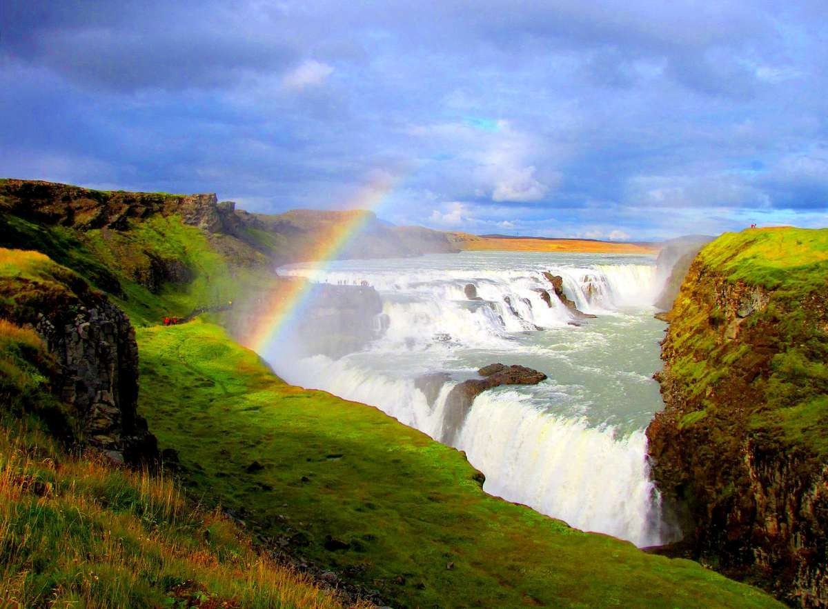
Gullfoss drops 32 meters across 2 tiers into a narrow canyon on the Hvítá River, part of Iceland's Golden Circle route alongside Þingvellir National Park and the Geysir geothermal area. Sigríður Tómasdóttir, a local farmer's daughter, campaigned against a hydroelectric plan for the falls in the early 20th century, threatening to throw herself into the waterfall if construction proceeded; the plan was later abandoned, and Iceland credits her as an early figure in the country's environmental protection movement.
Best time: Midday in summer for the strongest chance of a visible rainbow in the spray; winter brings partial ice formations along the canyon edges.
Highlights
- 32m drop across 2 tiers on the Hvítá River
- Part of the Golden Circle route alongside Þingvellir and Geysir
- A local farmer's daughter, Sigríður Tómasdóttir, helped block a hydroelectric plan for the falls in the early 20th century
Cost
Free. Iceland charges no entrance fee for Gullfoss; parking is free as well.
How to reach
A roughly 1.5-hour drive from Reykjavík via Route 35, typically visited as part of a Golden Circle day trip alongside Þingvellir National Park and the Geysir geothermal area.
Rhine Falls:
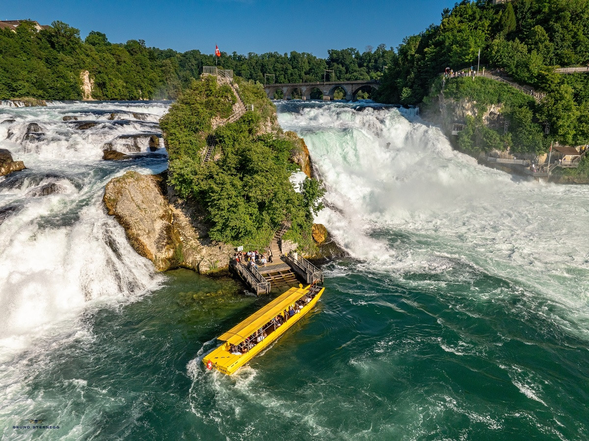
Rhine Falls formed roughly 14,000 to 17,000 years ago during the last ice age and ranks as Europe's most powerful waterfall by water volume, dropping 23 meters across a 150-meter width. Boat tours run directly to the base and to a rock outcrop in the middle of the falls during warmer months, and the site includes both a historic castle (Laufen Castle) with viewing platforms and a newer visitor platform on the opposite bank.
Best time: Summer for the boat tours to the central rock and the fullest flow; the falls run year-round regardless of season.
Highlights
- Europe's most powerful waterfall by water volume
- Formed roughly 14,000-17,000 years ago during the last ice age
- Laufen Castle offers viewing platforms directly above the falls
Cost
Free to view from the main platforms. Boat trips to the rock outcrop mid-falls cost roughly CHF 8-30 depending on the route; parking runs CHF 5 for the first hour.
How to reach
Take a direct train to Neuhausen Rheinfall or Schloss Laufen station from Zürich (about 45 minutes) or Schaffhausen (a few minutes); both stations sit a short walk from the falls.
Plitvice Waterfalls:
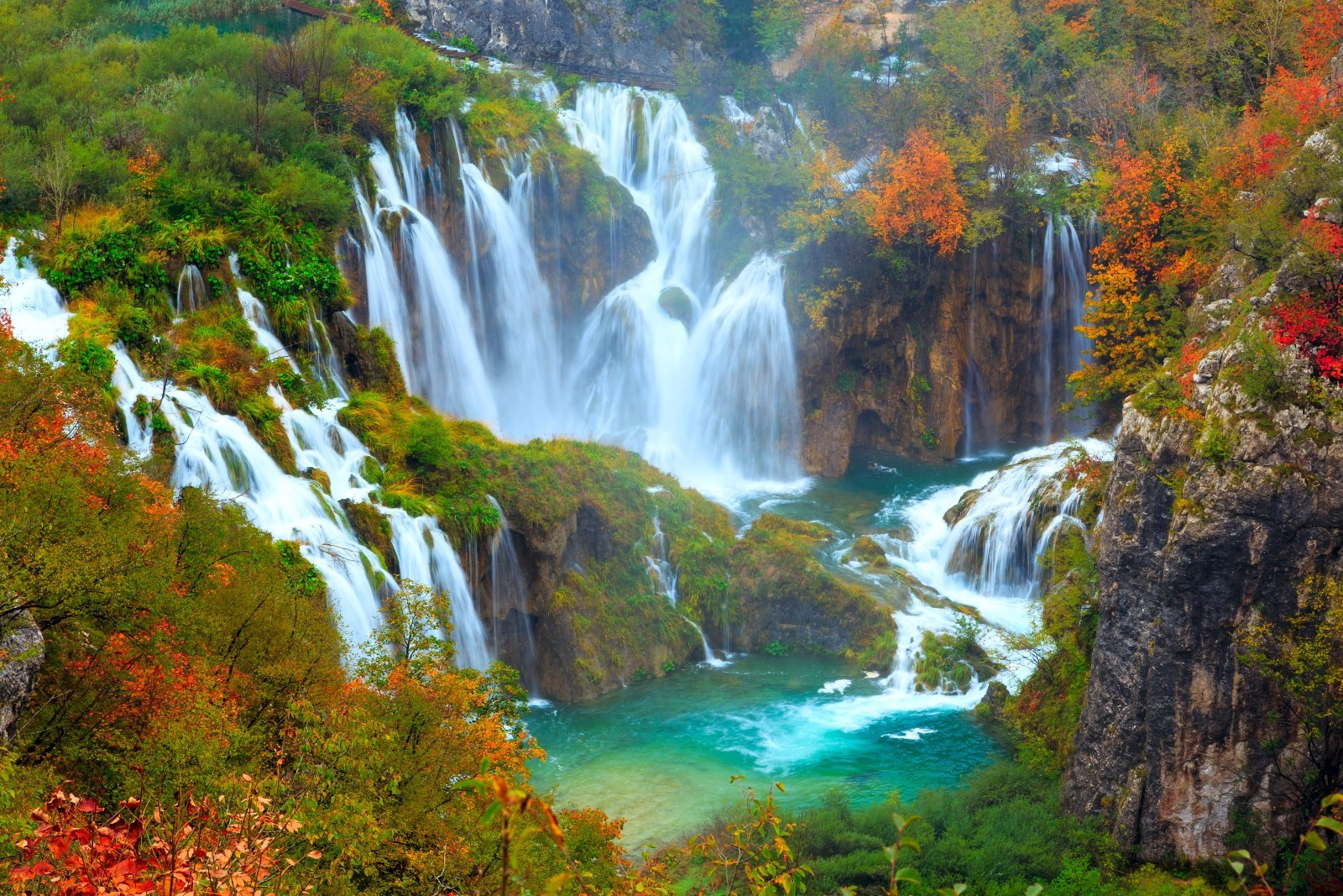
Plitvice's waterfalls connect a system of 16 terraced lakes, formed by natural travertine barriers that build up over centuries as calcium carbonate deposits from the water. The park has held UNESCO World Heritage status since 1979, and wooden boardwalks wind directly over and beside the water across most of the park, letting visitors walk within a few feet of multiple cascades without needing a boat or a strenuous hike.
Best time: May-June or September-October for fewer crowds than peak summer with still-reliable warm weather.
Highlights
- 16 interconnected lakes formed by natural travertine barriers
- UNESCO World Heritage Site since 1979
- Wooden boardwalks run directly over and beside the water throughout the park
Cost
Entrance runs roughly EUR 25-40 depending on season (higher in summer, lower off-peak), and includes the park's internal boat and shuttle transport.
How to reach
Roughly a 2-hour drive from Zagreb or Zadar; regular intercity buses also connect both cities to the park entrance, which has its own bus stop.
Seljalandsfoss Falls:
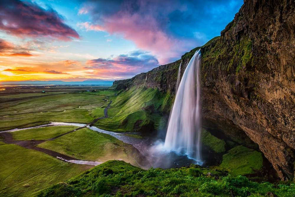
Seljalandsfoss Falls drops 60 meters and sits close enough to Iceland's Ring Road that it functions as one of the country's most accessible major waterfalls, fed by meltwater originating from the Eyjafjallajökull volcano's glacier. A path circles fully behind the curtain of falling water, a rare feature among waterfalls this size, though the walkway turns genuinely slick and requires real caution in wet or icy conditions.
Best time: Late May through early July for the greenest surrounding landscape; winter access behind the falls often closes due to ice.
Highlights
- 60m drop, fed by meltwater from the Eyjafjallajökull volcano's glacier
- A path circles fully behind the curtain of falling water
- Sits directly beside Iceland's Ring Road, among the country's most accessible major waterfalls
Cost
Free to view. A small parking fee (roughly ISK 700-800) applies at the main car park.
How to reach
A roughly 2-hour drive from Reykjavík along Route 1 (the Ring Road); the falls sit directly visible from the highway with a large car park at the base.
Bigar Cascade Falls:
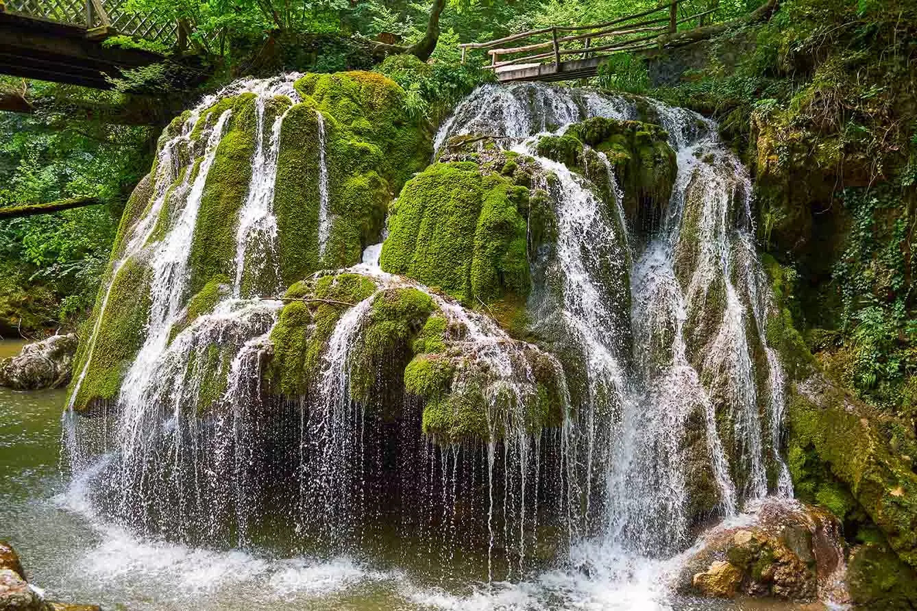
Bigar Cascade Falls drops water over rounded, moss-covered ledges on the Miniș River, splitting into countless small streams as it descends. It doesn't fall as a single sheet, a genuinely unusual structure compared to most waterfalls. The moss coverage depends on consistent moisture and shade, and heavy rain or drought years visibly change how much of the rock face stays green.
Best time: Spring through early summer, when consistent rainfall keeps the moss coverage at its fullest and greenest.
Highlights
- Water splits into countless small streams over moss-covered ledges
- A genuinely different structure from a standard single-sheet waterfall
- Moss coverage changes visibly with rainfall and season
Cost
Free; no entrance fee at the site.
How to reach
A roughly 3-hour drive from Timișoara through the Anina Mountains; the falls sit directly beside the road with a small pull-off parking area, no hike required.
2 waterfallsAfrica:
Southern Africa holds both a UNESCO icon known locally as "the smoke that thunders" and a waterfall whose total drop rivals the tallest in the world.
Victoria Falls:
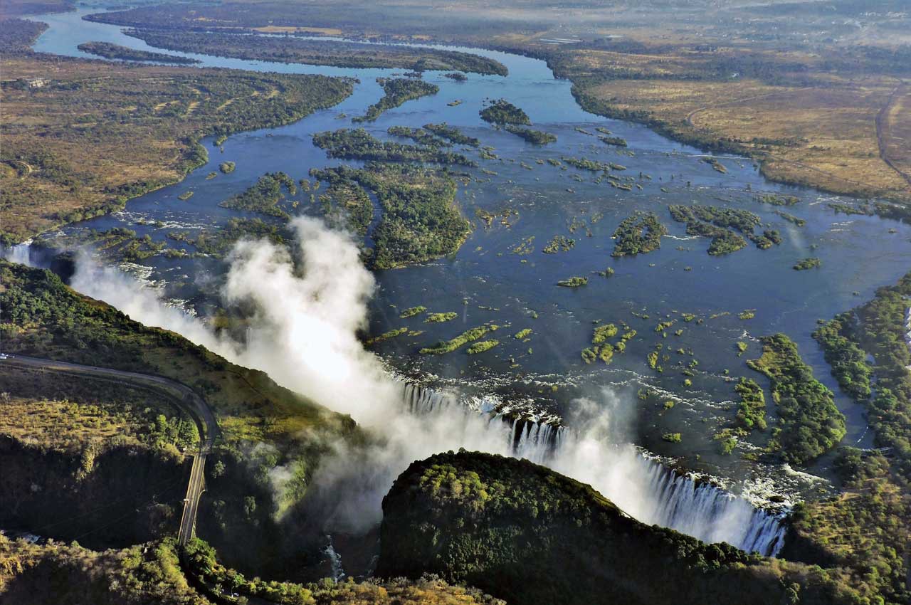
Victoria Falls stretches 1,708 meters wide with a maximum drop of 108 meters, and the local Lozi name, Mosi-oa-Tunya ("the smoke that thunders"), describes the spray visible from kilometers away during peak flow. UNESCO listed it as a World Heritage Site in 1989, and activities on either side range from calmer sightseeing on the Zambian side to the more adrenaline-heavy bungee jumping and white-water rafting concentrated on the Zimbabwean side.
Best time: February through May for the fullest flow (though heavy spray can obscure views); August through December for clearer sightlines with reduced water volume.
Highlights
- 1,708m wide, one of the widest curtains of falling water on Earth
- UNESCO World Heritage Site since 1989
- Activities range from calm sightseeing (Zambia) to bungee jumping and rafting (Zimbabwe)
Cost
Zimbabwe side park entry runs around USD $30-50 for international visitors; Zambia side runs similarly, roughly USD $20-30. Activities (bungee, rafting, helicopter) are priced separately.
How to reach
Fly into Victoria Falls Airport (Zimbabwe) or Harry Mwanga Nkumbula International (Zambia). Both airports sit within a 20-30 minute drive of the falls, and the Victoria Falls Bridge connects the 2 countries on foot for day-trippers crossing between sides.
Tugela Falls:
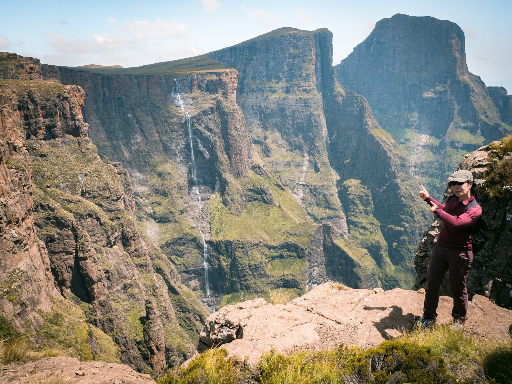
Tugela Falls drops a combined 947 meters across 5 tiers in the Drakensberg mountain range, with the tallest single uninterrupted section measuring roughly 411 meters. Precise measurement of multi-tier waterfalls like this one varies by source and survey method, and Tugela's exact world ranking among the tallest waterfalls shifts depending on which measurement standard is applied, though it consistently ranks among the tallest in Africa regardless of the specific figure used.
Best time: After heavy rains, since Tugela's flow varies enormously and can reduce to a comparative trickle during drier stretches of the year.
Highlights
- ~947m combined drop across 5 tiers
- Tallest single section measures roughly 411m
- Flow varies enormously by season, most dramatic after heavy rain
Cost
Royal Natal National Park charges a modest daily conservation fee, typically under USD $5 for international visitors.
How to reach
Fly into King Shaka International (Durban) and drive roughly 3 hours to Royal Natal National Park. The main viewpoint requires a moderate hike from the Mahai or Thendele camps inside the park.
6 waterfallsAsia:
From a UNESCO-adjacent cross-border cascade to a seasonal Indian waterfall that only reaches full force during monsoon.
Ban Gioc Waterfall:
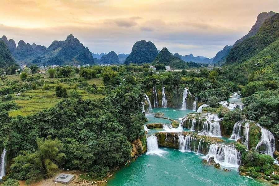
Ban Gioc (known as Detian Falls on the Chinese side) spans roughly 300 meters across 3 tiers in a horseshoe shape, making it the widest waterfall on the Vietnam-China border and among the widest in Asia. Bamboo rafts operate directly on the river at the base, letting visitors approach close enough to see both countries' viewing areas from the water, a genuinely unusual setup for a waterfall straddling an international border.
Best time: August through October, after the summer rainy season fills the river without the flooding risk of peak monsoon months.
Highlights
- ~300m wide, the widest waterfall on the Vietnam-China border
- 3 tiers forming a horseshoe shape
- Bamboo rafts let visitors approach the base directly from the river
Cost
Entrance fee runs roughly VND 45,000-70,000 (under USD $3); bamboo raft rides to the base cost an additional VND 50,000-100,000 per person.
How to reach
A roughly 6-7 hour drive from Hanoi to Cao Bang, then another hour to the falls; most visitors join a multi-day tour from Hanoi given the distance and limited direct public transport.
Jog Falls:
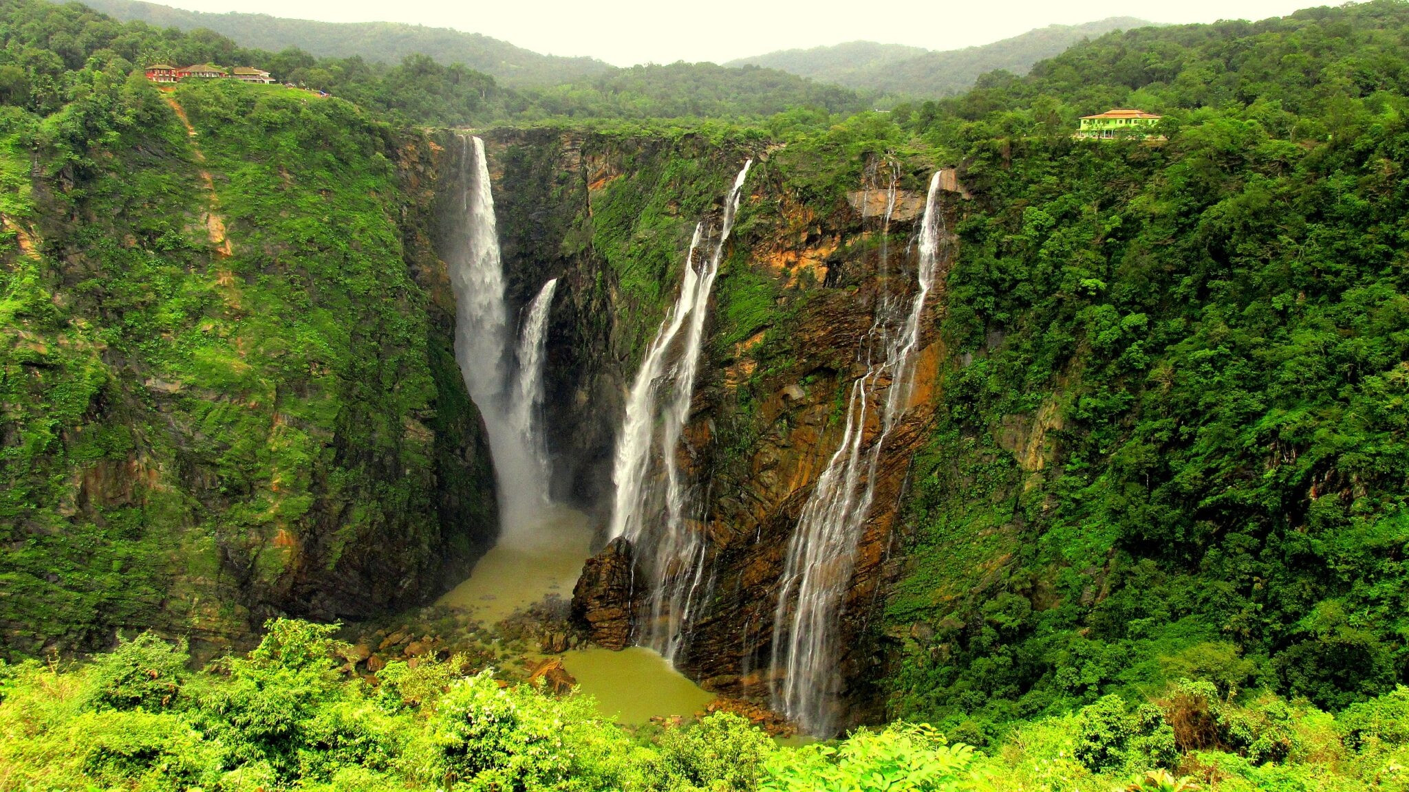
Jog Falls drops 253 meters across 4 distinct sections locally named Raja, Rani, Rocket, and Roarer, and it runs as a genuinely seasonal waterfall, most powerful during the monsoon (roughly June through September) and reduced to a comparative trickle for much of the dry season since upstream dam releases now control most of the river's flow outside monsoon months.
Best time: July through September during monsoon season, when the falls run at genuinely full force. The rest of the year, dam releases reduce it considerably.
Highlights
- 253m drop across 4 named sections: Raja, Rani, Rocket, and Roarer
- A genuinely seasonal waterfall, most powerful during monsoon
- Reduced to a comparative trickle outside monsoon season due to upstream dam releases
Cost
Free entry to the main viewpoints; a small parking fee applies at the main car park.
How to reach
Fly into Mangalore International Airport and drive roughly 3-3.5 hours, or take a train to Talaguppa station followed by a short taxi ride to the falls.
Dudhsagar Falls:
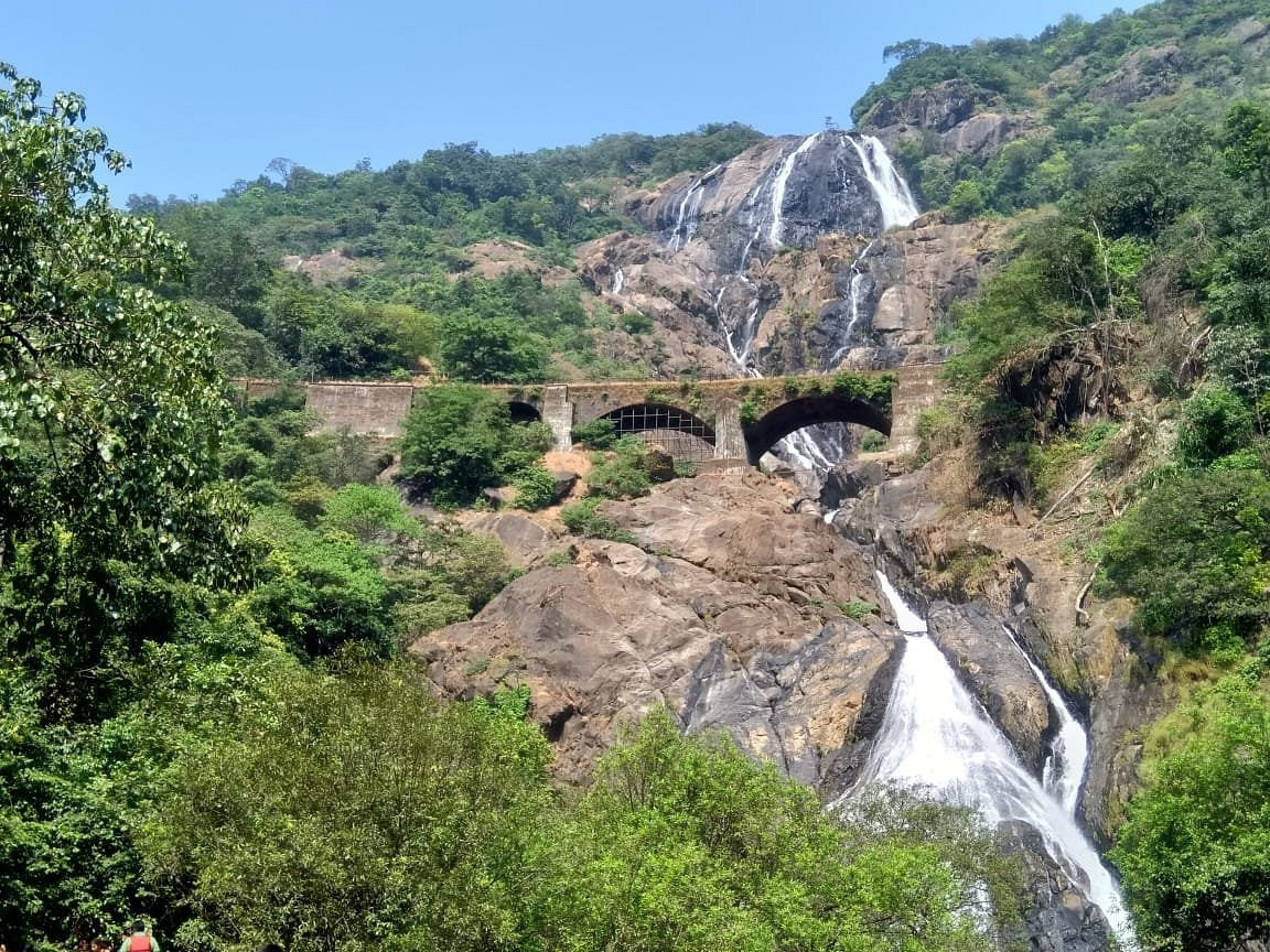
Dudhsagar ("sea of milk" in Konkani) drops 310 meters across 4 tiers, and the milky-white appearance the name describes comes from the water aerating heavily as it strikes rock ledges partway down. Mineral content isn't the cause. The falls sit directly beside an active railway line, and the Vasco-Castle Rock train route offers passing views from the tracks alongside the more common jeep-and-hike access route through Bhagwan Mahavir Wildlife Sanctuary.
Best time: October through May, just after monsoon season through the dry months; access often closes entirely during peak monsoon flooding.
Highlights
- 310m drop across 4 tiers on the Mandovi River
- Milky-white appearance comes from water aeration, not mineral content
- Visible from the Vasco-Castle Rock railway line
Cost
Entry via the Bhagwan Mahavir Wildlife Sanctuary jeep safari runs roughly INR 400-600 per person; trekking access has a separate, smaller forest department fee.
How to reach
Fly into Goa's Dabolim or Manohar International Airport, then drive roughly 1.5-2 hours to Kulem or Castle Rock, where jeep safaris or guided treks depart for the falls.
Kawasan Falls:
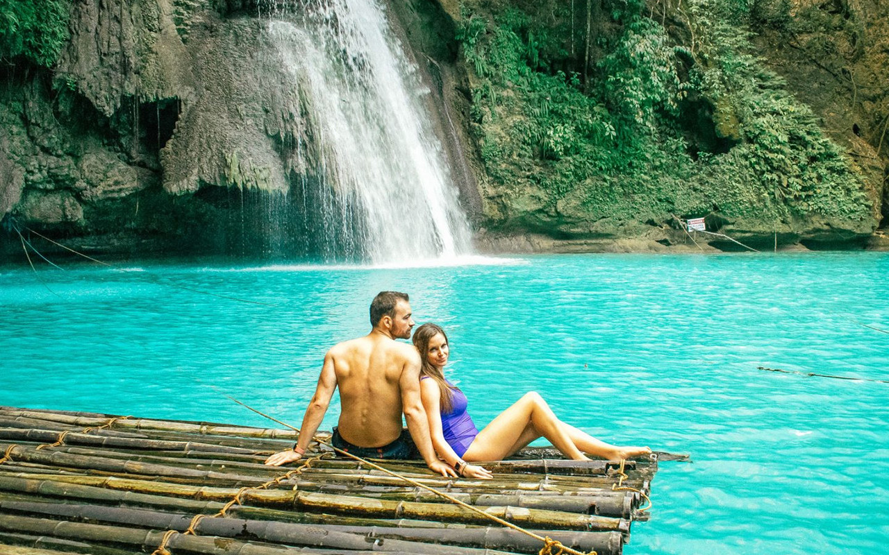
Kawasan Falls runs as a series of multi-tiered cascades into turquoise pools framed by limestone canyon walls, at the base of the Mantalongon mountain range on Cebu Island. Canyoneering tours here combine cliff jumping, rope swings, and swimming through the multiple pools in sequence, a genuinely more active way to experience the falls than the standard viewpoint-and-swim approach most waterfalls on this list offer.
Best time: December through May, the dry season, avoiding the typhoon-prone months from roughly June through November.
Highlights
- Multi-tiered turquoise pools framed by limestone canyon walls
- Canyoneering tours combine cliff jumping, rope swings, and swimming through multiple pools
- Located at the base of the Mantalongon mountain range on Cebu Island
Cost
Entrance fee runs roughly PHP 30-50 (under USD $1). Canyoneering tours with a guide cost roughly USD $25-40 per person depending on group size and route length.
How to reach
Fly into Mactan-Cebu International Airport, then take a bus or private van roughly 3 hours south to Badian. Habitual jump-off points sit a short walk or tricycle ride from Badian's town center.
Tukad Cepung Waterfall:
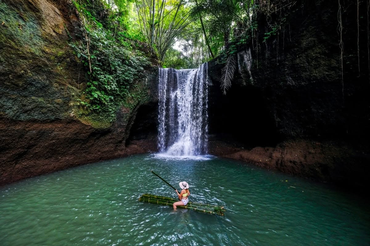
Tukad Cepung drops roughly 15 meters inside a narrow canyon, and its main draw is the light: around midday, sunlight filters through a gap in the canyon walls above and casts a visible beam directly onto the falling water, a genuinely photogenic effect specific to this waterfall's geology. Reaching it requires a roughly 15-minute walk along a jungle trail, considerably shorter than most Bali waterfall hikes.
Best time: Around midday (11am-1pm) for the strongest light beam effect through the canyon opening; visit on a clear, sunny day.
Highlights
- A midday light beam effect through a gap in the canyon walls
- A short 15-minute walk, shorter than most Bali waterfall hikes
- A cooling pool at the base for swimming
Cost
Entrance fee runs roughly IDR 15,000-20,000 (under USD $1.50).
How to reach
A roughly 45-60 minute drive east of Ubud; most visitors combine it with other eastern Bali stops like Tirta Empul or Mount Batur on the same day.
Tegenungan Waterfall:
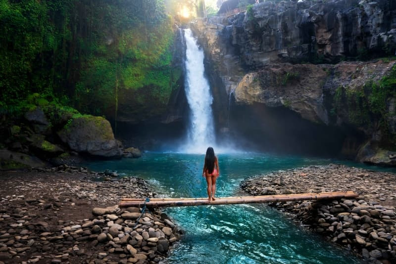
Tegenungan drops 25 meters in a wide, powerful curtain surrounded by dense jungle, and unlike Tukad Cepung's narrow canyon setting, it's fully open to the sky, giving it a considerably different character despite sitting in the same general region of Bali. A concrete stairway leads down to the base, where a plunge pool allows swimming, and nearby food stalls and small cafes make it an easy half-day stop, not a dedicated expedition.
Best time: Early morning or evening for softer light and thinner crowds; visit outside the main midday tour-bus window.
Highlights
- 25m wide curtain drop, open to the sky
- A plunge pool at the base allows swimming
- Food stalls and cafes nearby make it an easy half-day stop
Cost
Entrance fee runs roughly IDR 20,000-30,000 (under USD $2).
How to reach
A roughly 20-30 minute drive south of Ubud by car or scooter, often combined with other central Bali stops on the same day.
2 waterfallsOceania:
New Zealand and Australia both hold major waterfalls reachable only by serious effort, one by a multi-day hike, the other by 4WD-only track.
Sutherland Falls:
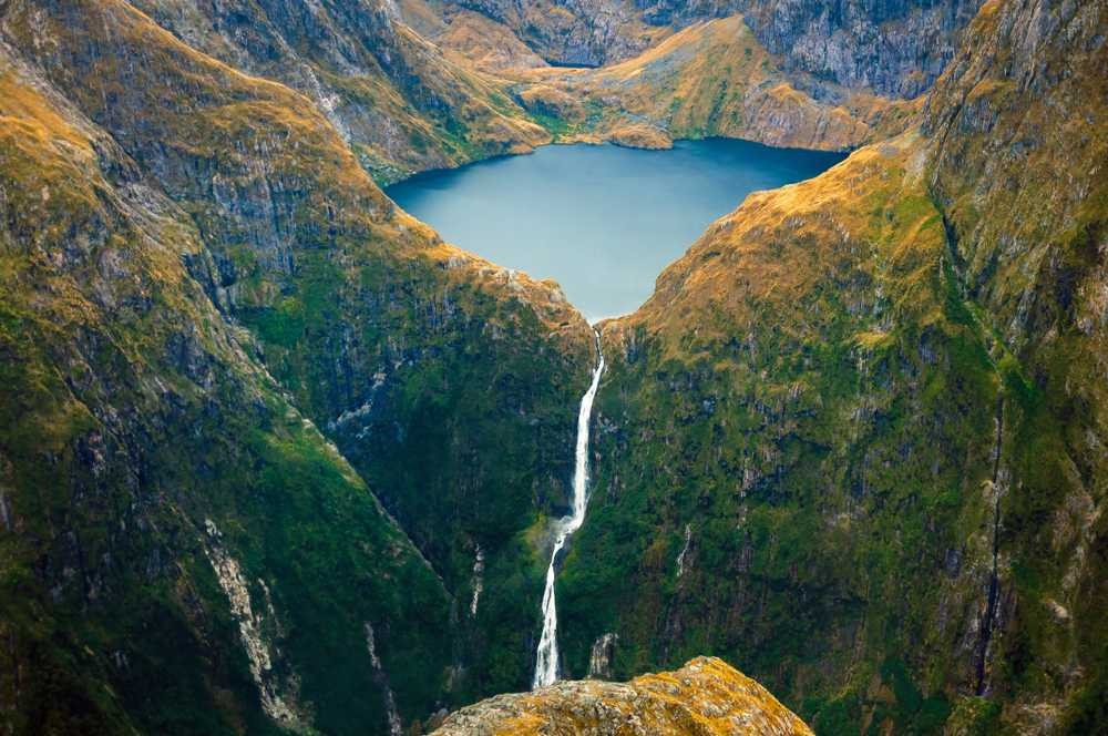
Sutherland Falls drops 580 meters across 3 tiers between Lake Quill and the Arthur River, with its tallest single section measuring 270 meters, and it ranks among the tallest waterfalls in New Zealand. Reaching it requires either a scenic flight or a hike along the Milford Track, a multi-day trek through Fiordland National Park that itself ranks among New Zealand's most celebrated long-distance walks, meaning the falls function as a genuine trekking destination, not a roadside stop.
Best time: November through April, New Zealand's summer, for the most reliable weather along the Milford Track.
Highlights
- 580m total across 3 tiers, tallest single section 270m
- Reachable only by scenic flight or the multi-day Milford Track hike
- Sits between Lake Quill and the Arthur River in Fiordland National Park
Cost
No separate fee for the falls; Milford Track hut bookings (required for the multi-day hike) cost roughly NZD 90-140 per night per hut during the Great Walks season.
How to reach
Fly into Queenstown, then either book a scenic flight directly to the falls or arrange Milford Track hut bookings well in advance (the Great Walks season books out months ahead).
Jim Jim Falls:
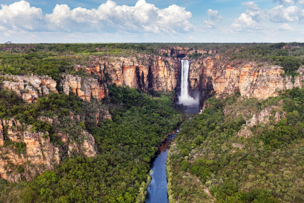
Jim Jim Falls drops roughly 200 meters over the Arnhem Land escarpment inside UNESCO-listed Kakadu National Park, and its English name comes from andjimdjim, the local word for the water pandanus plant growing along the creek below. The falls run seasonally: during the dry season (roughly June through October) the water often reduces to a trickle or stops, while the wet season (November through May) makes road access impossible entirely, leaving a scenic flight as the only way to see the falls at full flow. Jim Jim Falls is closed for the entire 2026 dry season for road and infrastructure upgrades, worth confirming directly with Kakadu National Park before planning a visit around it.
Best time: Normally June through October for road access, though check current closure status before planning around this specific waterfall in 2026.
Highlights
- ~200m drop, Kakadu's tallest waterfall
- Closed for the entire 2026 dry season for road and infrastructure upgrades
- Wet season access is by scenic flight only; the road is impassable
Cost
A Kakadu National Park pass is required: roughly AUD $40 (dry season) or AUD $25 (wet season) per adult, valid for 7 days and covering all of Kakadu's sights.
How to reach
Fly into Darwin, then drive roughly 2.5-3 hours to the Jim Jim Falls turnoff on the Kakadu Highway, followed by a high-clearance 4WD-only track for the final stretch. Confirm current closure status before planning around this specific waterfall.
Frequently Asked Questions (FAQ's):
Q. What is the tallest waterfall in the world?
Angel Falls in Venezuela, at 979 meters total with an 807-meter uninterrupted free fall. It's named after American aviator Jimmie Angel, who crash-landed his plane on the adjacent plateau in 1933.






{{item.get_author.first_name}} {{item.get_author.last_name}}
Level 7
5 Photos
36 Reviews
{{item.comment_txt}}
{{item_reply.get_author.first_name}} {{item_reply.get_author.last_name}}
@ {{item_reply.reply_to}}, {{item_reply.reply_txt}}